Morehead in Rowan County, Kentucky — The American South (East South Central)
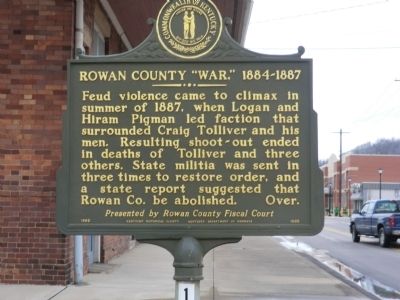
Rowan County "War," 1884-1887
Erected 1993 by Kentucky Historical Society-Kentucky Department of Highways. (Marker Number 1933.)
Topics and series. This memorial is listed in this topic list: Notable Events. In addition, it is included in the Kentucky Historical Society series list.
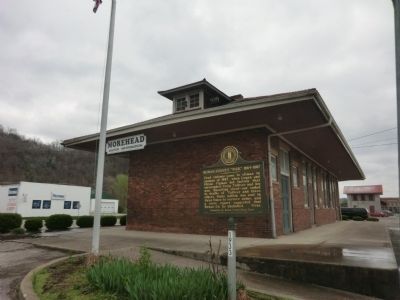
Location. 38° 10.932′ N, 83° 25.968′ W. Marker is in Morehead, Kentucky, in Rowan County. Memorial is on East 1st Street. The marker is located on the grounds of the Morehead Visitor Center. Touch for map. Marker is in this post office area: Morehead KY 40351, United States of America. Touch for directions.
Other nearby markers. At least 8 other markers are within walking distance of this marker. Rowan County War Memorial (a few steps from this marker); In Memory of the Victims of the 1939 Flood (within shouting distance of this marker); Morehead Chesapeak And Ohio Railway Freight Depot (about 300 feet away, measured in a direct line); Moonlight Schools (about 400 feet away); Spirit of the American Doughboy (about 600 feet away); Allie Young Law Office (about 800 feet away); Freedom Park (about 800 feet away); Courthouse Burned (approx. 0.2 miles away). Touch for a list and map of all markers in Morehead.
Also see . . . Rowan County War - Wikipedia. (Submitted on May 21, 2014, by Bill Pfingsten of Bel Air, Maryland.)
Credits. This page was last revised on June 16, 2016. It was originally submitted on May 19, 2014, by Don Morfe of Baltimore, Maryland. This page has been viewed 627 times since then and 32 times this year. Photos: 1, 2. submitted on May 19, 2014, by Don Morfe of Baltimore, Maryland. • Bill Pfingsten was the editor who published this page.

