St. Augustine in St. Johns County, Florida — The American South (South Atlantic)
St. Johns Railway
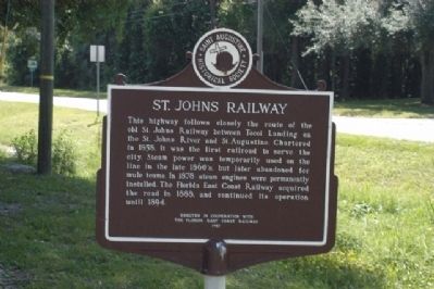
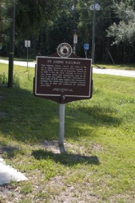
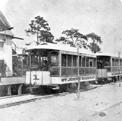
This highway follows closely the route of the old St. Johns Railway between Tocoi Landing on the St. Johns River and St. Augustine. Chartered in 1858, it was the first railroad to serve the city. Steam power was temporarily used on the line in the late 1860’s, but later abandoned for mule teams. In 1878, steam engines were permanently installed. The Florida East Coast Railway acquired the road in 1888, and continued its operation until 1894.
Erected 1957 by The Florida East Coast Railway, Saint Augustine Historical Society.
Topics and series. This historical marker is listed in this topic list: Railroads & Streetcars. In addition, it is included in the Florida East Coast Railroad and Hotels, and the Historically Black Colleges and Universities series lists. A significant historical year for this entry is 1858.
Location. 29° 53.258′ N, 81° 21.235′ W. Marker is in St. Augustine, Florida, in St. Johns County. Marker is on West King Street (County Road 214) east of North Holmes Boulevard, on the right when traveling west. Touch for map. Marker is in this post office area: Saint Augustine FL 32084, United States of America. Touch for directions.
Other nearby markers. At least 8 other markers are within 2 miles of this marker, measured as the crow flies. Florida Memorial University (within shouting distance of this marker); Our Native Son Lieutenant General Ronald L. Bailey (within shouting distance of this marker); 1074 West King Street (approx. ¼ mile away); Zora Neale Hurston (approx. 0.8 miles away); New Augustine Colored Elementary School #36 (approx. 0.9 miles away); Pinehurst Cemetery (approx. one mile away); San Sebastian Cemetery (approx. one mile away); 650 Julia Street (approx. 1.1 miles away). Touch for a list and map of all markers in St. Augustine.
More about this marker. This marker is located on the grounds of the Florida Memorial University, which also has a Marker.
Credits. This page was last revised on October 28, 2020. It was originally submitted on May 20, 2014, by James R. Murray of Elkton, Florida. This page has been viewed 857 times since then and 65 times this year. Photos: 1, 2. submitted on May 20, 2014, by James R. Murray of Elkton, Florida. 3. submitted on May 20, 2014. • Bernard Fisher was the editor who published this page.


