St. Simons Island in Glynn County, Georgia — The American South (South Atlantic)
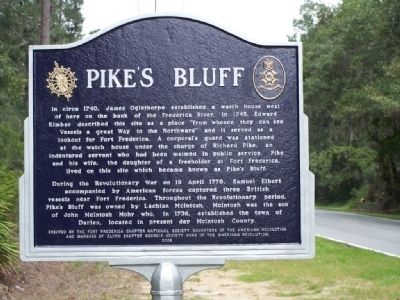
Pike's Bluff
In circa 1740, James Oglethorpe established a watch house west of here on the bank of the Frederica River. In 1745, Edward Kimber described this site as a place "from whence they can see Vessels a great Way to the Northward" and it served as a lookout for Fort Frederica. A corporal's guard was stationed at the watch house under the charge of Richard Pike, an indentured servant who had been maimed in public service. Pike and his wife, the daughter of a freeholder at Fort Frederica, lived on this site which became known as Pike's Bluff.
During the Revolutionary War on 19 April 1778, Samuel Elbert accompanied by American forces captured three British vessels near Fort Frederica. Throughout the Revolutionary period, Pike's Bluff was owned by Lachlan McIntosh. McIntosh was the son of John McIntosh Mohr who, in 1736, established the town of Darien, located in present day McIntosh County.
Erected 2008 by The Fort Frederica Chapter National Society Daughters of the American Revolution and Marshes of Glynn Chapter Georgia Society Sons of the American Revolution.
Topics and series. This historical marker is listed in these topic lists: Colonial Era • Forts and Castles • Settlements & Settlers • War, US Revolutionary. In addition, it is included in the Daughters of the American Revolution, and the Sons of the American Revolution (SAR) series lists. A significant historical date for this entry is April 19, 1778.
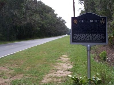
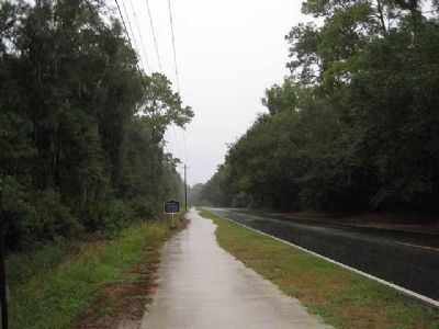
Location. 31° 14.393′ N, 81° 21.206′ W. Marker is on St. Simons Island, Georgia, in Glynn County. Marker is on Lawrence Road, on the left when traveling north. Touch for map. Marker is in this post office area: Saint Simons Island GA 31522, United States of America. Touch for directions.
Other nearby markers. At least 8 other markers are within 3 miles of this marker, measured as the crow flies. Sinclair Plantation (approx. 0.3 miles away); Cannon's Point Plantation (approx. 0.9 miles away); German Village (approx. 0.9 miles away); Hampton Plantation (approx. 1.1 miles away); Harrington Hall (approx. 1˝ miles away); The Georgia Navy (approx. 2.3 miles away); William Bartram Trail (approx. 2.3 miles away); St. Simons Island (approx. 2.3 miles away). Touch for a list and map of all markers in St. Simons Island.
Regarding Pike's Bluff. On the western side of the island, the Hazzard brothers, sons of a South Carolina Revolutionary War veteran who had settled on St. Simons Island in
the early 1800s, developed the plantations of West Point and Pike's Bluff.
Also see . . . Georgia's Land of the Golden Isles By Burnette Lightle Vanstory, Burnette Vanstory,Eugenia Price. Pages 191-192 West Point and Pike's Bluff. (Submitted on October 16, 2008, by Mike Stroud of Bluffton, South Carolina.)
Credits. This page was last revised on November 25, 2020. It was originally submitted on October 16, 2008, by Mike Stroud of Bluffton, South Carolina. This page has been viewed 2,173 times since then and 113 times this year. Last updated on May 21, 2014, by Keith S Smith of West Chester, Pennsylvania. Photos: 1, 2. submitted on October 16, 2008, by Mike Stroud of Bluffton, South Carolina. 3. submitted on September 29, 2010, by Byron Hooks of Sandy Springs, Georgia. • Bill Pfingsten was the editor who published this page.


