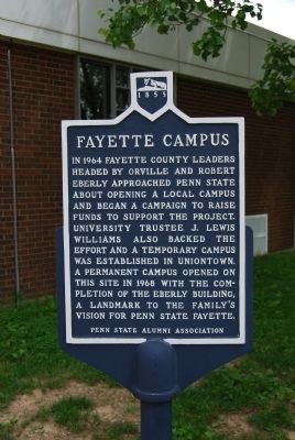
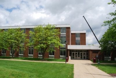
Near Uniontown in Fayette County, Pennsylvania — The American Northeast (Mid-Atlantic)
Fayette Campus
Penn State University
Erected by Penn State Alumni Association.
Topics and series. This historical marker is listed in this topic list: Education. In addition, it is included in the Pennsylvania State University series list. A significant historical year for this entry is 1964.
Location. 39° 56.821′ N, 79° 39.445′ W. Marker is near Uniontown, Pennsylvania, in Fayette County. Marker can be reached from University Drive (U.S. 119). Marker is located at the Eberly Building on the Fayette Campus. Touch for map. Marker is in this post office area: Uniontown PA 15401, United States of America. Touch for directions.
Other nearby markers. At least 8 other markers are within 3 miles of this marker, measured as the crow flies. Connellsville Coke Region (about 600 feet away, measured in a direct line); Meason House (approx. half a mile away); Gist's Plantation (approx. 0.6 miles away); Veterans Memorial (approx. 0.7 miles away); Lemont Furnace Honor Roll (approx. 2.2 miles away); In Honor of Those Who Serve - For God and Country (approx. 2.8 miles away); a different marker also named In Honor of Those Who Serve - For God and Country (approx. 2.8 miles away); Dunbar Korean War Memorial (approx. 2.8 miles away).
Also see . . . Penn State, Fayette, The Eberly Campus. (Submitted on May 23, 2014, by Mike Wintermantel of Pittsburgh, Pennsylvania.)
Credits. This page was last revised on December 29, 2020. It was originally submitted on May 23, 2014, by Mike Wintermantel of Pittsburgh, Pennsylvania. This page has been viewed 409 times since then and 10 times this year. Photos: 1, 2. submitted on May 23, 2014, by Mike Wintermantel of Pittsburgh, Pennsylvania.

