
Highland Park in Norfolk, Virginia — The American South (Mid-Atlantic)
Norfolk Light Artillery Blues
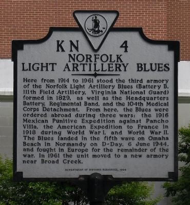
Photographed by PaulwC3, May 15, 2014
1. Norfolk Light Artillery Blues Marker
Here from 1914 to 1961 stood the third armory of the Norfolk Light Artillery Blues (Battery B, 111th Field Artillery, Virginia National Guard) formed in 1829, as well as the Headquarters Battery, Regimental Band, and the 104th Medical Corps Detachment. From here, the Blues were ordered abroad during three wars: the 1916 Mexican Punitive Expedition against Pancho Villa, the American Expedition to France in 1918 during World War I, and World War II. The Blues landed in the fifth wave on Omaha Beach in Normandy on D-Day, 6 June 1944, and fought in Europe for the remainder of the war. In 1961 the unit moved to a new armory near Broad Creek.
Erected 1998 by Department of Historic Resources. (Marker Number KN-4.)
Topics and series. This historical marker is listed in these topic lists: War, World I • War, World II. In addition, it is included in the Virginia Department of Historic Resources (DHR) series list. A significant historical date for this entry is June 6, 1944.
Location. 36° 53.141′ N, 76° 18.13′ W. Marker is in Norfolk, Virginia. It is in Highland Park. It is at the intersection of Hampton Boulevard (Virginia Route
this page online

Regionally, this marker is in Virginia’s Hampton Roads, specifically in Coastal Virginia, and in the Hampton Roads Metropolitan Area. It is also in the American South, specifically in the Upper South, in the Tidewater, and on the Eastern Seaboard. Globally, it is in the North Atlantic Region, North America, the Western Hemisphere, the Western World, and the Anglosphere. Historically, it finds itself in what was once the territory of the Mississippian Culture, one of the original Thirteen Colonies, one of the Confederate States of America, and the Antebellum South.
Other nearby markers. At least 8 other markers are within 2 miles of this marker, measured as the crow flies: Veterans Memorial (approx. 0.2 miles away); "Connections" (approx. 0.2 miles away); Quarantine Road (approx. ¼ mile away); Old Academic Building Site (approx. 0.4 miles away); Blair Junior High School
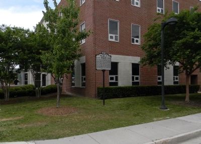
Photographed by PaulwC3, May 15, 2014
2. Wide view of the Norfolk Light Artillery Blues Marker
Also see . . . 111th Field Artillery Regiment. Wikipedia entry (Submitted on June 7, 2023, by Larry Gertner of New York, New York.)
Credits. This page was last revised on June 7, 2023. It was originally submitted on May 23, 2014, by PaulwC3 of Northern, Virginia. This page has been viewed 1,118 times since then and 72 times this year. Photos: 1, 2. submitted on May 24, 2014, by PaulwC3 of Northern, Virginia.
