Point of Rocks in Sweetwater County, Wyoming — The American West (Mountains)
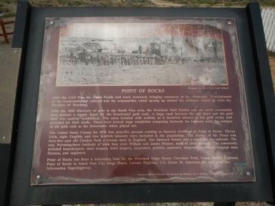
Point of Rocks
With the 1868 discovery of gold in the South Pass area, the Overland Mail Station and the small community here became a supply depot for the Sweetwater gold rush. A stage road between the rail head and the gold field was quickly established. The town bristle with activity as it funneled miners to the gold strike and provided for their needs. There were several stage companies competing furiously for business until the collapse of the gold rush as the Sweetwater mines played out.
The United State Census for 1870 lists sixty-five persons residing in fourteen dwellings at Point of Rocks. Eleven Irish, eight English, and two Scottish laborers were included in the population. The Justice of the Peace was forty-five year old Carolyn Neal, a woman born in England. Her husband Robert was a clerk for the railroad. The only Wyoming-born residents of town were William and James Whalen, born of Irish parents. The community included housekeepers, store keepers, hotel keepers, carpenters, grocers, teamsters, telegraph operators, baggage men, firemen and engineers.
Point of Rocks has been a welcoming host for the Overland Stage Route, Cherokee Trail, Union Pacific Railroad, Point of Rocks to South Pass City Stage Route, Lincoln Highway, U.S. Route 30, Interstate 80 and even the Information Superhighway.
Erected 2008 by Wyoming State Parks, Historic Sites and Trails.
Topics. This historical marker is listed in these topic lists: Railroads & Streetcars • Roads & Vehicles • Settlements & Settlers. A significant historical year for this entry is 1868.
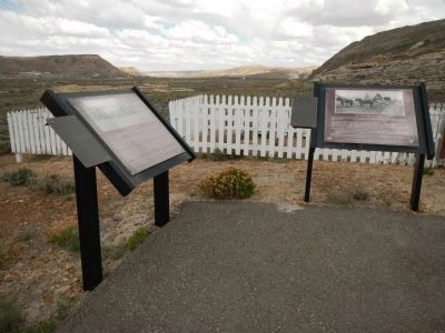
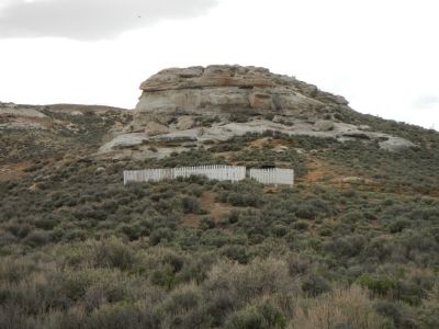
Location. 41° 40.628′ N, 108° 47.634′ W. Marker is in Point of Rocks, Wyoming, in Sweetwater County. Marker can be reached from Overland Trail near Black Butte Road, on the left when traveling west. This marker is found beside a small, hillside cemetery located to the west of the the Point of Rocks Stage Station. Touch for map. Marker is in this post office area: Point of Rocks WY 82942, United States of America. Touch for directions.
Other nearby markers. At least 8 other markers are within 11 miles of this marker, measured as the crow flies. An Unsolved Mystery (here, next to this marker); Point of Rocks Stage Station (approx. 0.2 miles away); Overland Stage Route (approx. 0.6 miles away); Almond Overland Stage Station (approx. 0.6 miles away); Immigrants (approx. 10.7 miles away); Working in the Mines (approx. 10.7 miles away); Town Development
(approx. 10.7 miles away); Opening the Mines (approx. 10.8 miles away). Touch for a list and map of all markers in Point of Rocks.
Credits. This page was last revised on December 6, 2020. It was originally submitted on May 25, 2014, by Barry Swackhamer of Brentwood, California. This page has been viewed 645 times since then and 26 times this year. Photos: 1, 2, 3. submitted on May 25, 2014, by Barry Swackhamer of Brentwood, California. • Bill Pfingsten was the editor who published this page.


