Upper Marlboro in Prince George's County, Maryland — The American Northeast (Mid-Atlantic)
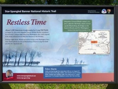
Restless Time
Star-Spangled Banner National Historic Trail
Photographed by Allen C. Browne, May 25, 2014
1. Restless Time Marker
Fearing a night attack, Winder moved the troops to the Washington Navy Yard. British patrols en route to Bladensburg arrived at Long Old Fields just after the Americans left.
Erected 2014 by National Park Service.
Topics and series. This historical marker is listed in this topic list: War of 1812. In addition, it is included in the Star-Spangled Banner National Historic Trail series list. A significant historical year for this entry is 1814.
Location. 38° 48.025′ N, 76° 49.533′ W. Marker is in Upper Marlboro, Maryland, in Prince George's County. It can be reached from Woodyard Road. The marker is in Mellwood Pond Community Park on Woodyard Road. Touch for map. Marker is at or near this postal address: 6491 Woodyard Road, Upper Marlboro MD 20772, United States of America. Touch for directions.

Regionally, this marker is in the Washington Metropolitan Area. It is
this page online
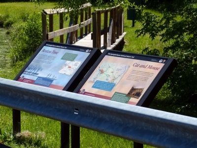
Other nearby markers. At least 8 other markers are within 3 miles of this marker, measured as the crow flies: Cat and Mouse (here, next to this marker); “Melwood Park” (approx. 0.9 miles away); Rosaryville State Park (approx. 1.7 miles away); Frederick Lee Eskew (approx. 1.7 miles away); His Lordship’s Kindness (approx. 1.8 miles away); Stables/Tack House (approx. 1.8 miles away); Slaves’ Infirmary [on His Lordship’s Kindness] (approx. 1.8 miles away); Mount Airy (approx. 2.4 miles away). Touch for a list and map of all markers in Upper Marlboro.
Photographed by Allen C. Browne, May 25, 2014
2. Restless Time Marker
Photographed by Allen C. Browne, May 25, 2014
3. Long Old Fields
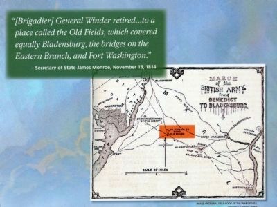
"[Brigadier] General Winder retired...to a place called Old Fields, which covered equally Bladensburg and the bridges on the Eastern Branch, and Fort Washington." - Secretary of State James Monroe, November 13, 1814. Close-up of Lossing's 1850 Map on marker
Photographed by Allen C. Browne, May 25, 2014
4. False Alarm
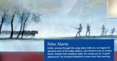
Cattle running through the camp about 2:00 a.m. on August 23 spooked some of the edgy soldiers, who feared it was the enemy attack. Despite their sleepless night, the troops put on "a good appearance" for President Madison's review that morning.Close-up of Gerry Embleton image on marker
Photographed by Allen C. Browne, May 25, 2014
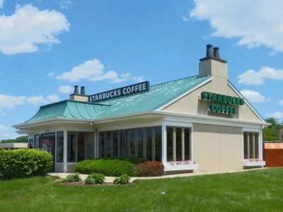
5. Starbucks at Long Old Fields
Starbucks in Forestville marks the approximate site of Long Old Fields. As Ralph Echelman says, "The area is heavily developed and retains no historical integrity."
Photographed by Allen C. Browne, May 25, 2014
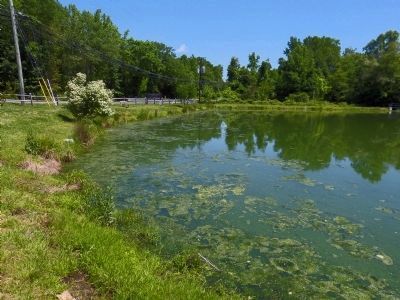
6. Mellwood Pond
Community Park
Donated by Mitchells
MNCPCC
Credits. This page was last revised on June 16, 2016. It was originally submitted on May 26, 2014, by Allen C. Browne of Silver Spring, Maryland. This page has been viewed 668 times since then and 18 times this year. Photos: 1, 2, 3, 4, 5, 6. submitted on May 26, 2014, by Allen C. Browne of Silver Spring, Maryland. • Bill Pfingsten was the editor who published this page.
