Attalla in Etowah County, Alabama — The American South (East South Central)
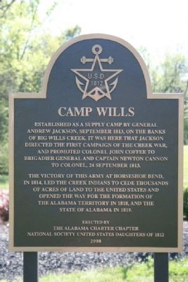
Camp Wills
The victory of this army at Horseshoe Bend, in 1814, led the Creek Indians to cede thousands of acres of land to the United States and opened the way for the formation of the Alabama Territory in 1818, and the State of Alabama in 1819.
Erected 2008 by the Alabama Charter Chapter National Society United States Daughters of 1812.
Topics and series. This historical marker is listed in this topic list: Wars, US Indian. In addition, it is included in the Former U.S. Presidents: #07 Andrew Jackson, and the United States Daughters of 1812, National Society series lists. A significant historical year for this entry is 1813.
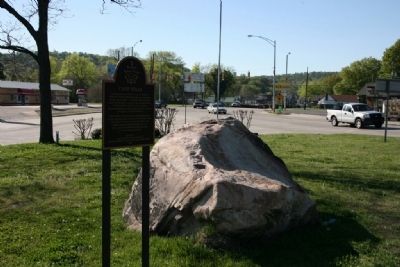
Location. 34° 1.157′ N, 86° 5.122′ W. Marker is in Attalla, Alabama, in Etowah County. Marker is at the intersection of 5th Avenue Northeast (U.S. 431) and Cleveland Avenue, on the right when traveling south on 5th Avenue Northeast. Touch for map. Marker is in this post office area: Attalla AL 35954, United States of America. Touch for directions.
Other nearby markers. At least 8 other markers are within 3 miles of this marker, measured as the crow flies . “The Junction” (here, next to this marker); Electricity for the City of Attalla (approx. 0.3 miles away); First United Methodist Church Of Attalla (approx. 0.3 miles away); William Patrick Lay (approx. 1.8 miles away); Camp Sibert (approx. 1.9 miles away); Alabama City, Alabama (approx. 2.3 miles away); Alabama City World War II Veterans Monument (approx. 2.3 miles away); Dwight Mill Village (approx. 2.3 miles away). Touch for a list and map of all markers in Attalla.
Credits. This page was last revised on December 12, 2016. It was originally submitted on December 21, 2010, by Timothy Carr of Birmingham, Alabama. This page has been viewed 1,574 times since then and 53 times this year. Last updated on May 26, 2014. Photos: 1, 2. submitted on December 21, 2010, by Timothy Carr of Birmingham, Alabama. • Bill Pfingsten was the editor who published this page.

