Near Junction City in Geary County, Kansas — The American Midwest (Upper Plains)
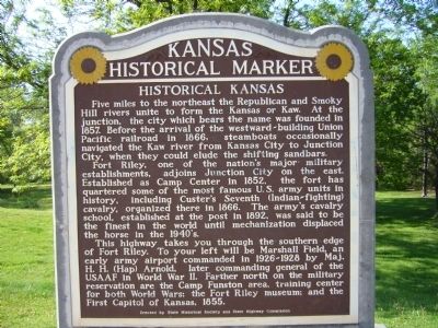
Historical Kansas
Five miles to the northeast the Republican and Smoky Hill rivers unite to form the Kansas or Kaw. At the junction, the city which bears the name, was founded in 1857. Before the arrival of the westward-building Union Pacific railroad in 1866, steamboats occasionally navigated the Kaw river from Kansas City to Junction City, when they could elude the shifting sandbars.
Fort Riley, one of the nation's major military establishments, adjoins Junction City on the east. Established as Camp Center in 1852, the fort has quartered some of the most famous U. S. army units in history, including Custer's Seventh (Indian-fighting) cavalry, organized there in 1866. The army's cavalry school, established at the post in 1892, was said to be the finest in the world until mechanization displaced the horse in the 1940s.
This highway takes you through the southern edge of Fort Riley. To your left will be Marshall Field, an early army airport commanded in 1926 - 1928 by Maj. H. H. (Hap) Arnold, later commanding general of the USAAF in World War II. Farther north on the military reservation are the Camp Funston area, training center for both World Wars; the Fort Riley museum; and the First Capitol of Kansas, 1855.
Erected by State Historical Society and State Highway Commission. (Marker Number 104.)
Topics and series. This historical marker is listed in these topic lists: Forts and Castles • Settlements & Settlers • War, World I • War, World II. In addition, it is included in the Kansas Historical Society series list. A significant historical year for this entry is 1857.
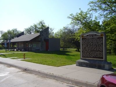
Location. Marker has been reported missing. It was located near 38° 59.994′ N, 96° 52.73′ W. Marker was near Junction City, Kansas, in Geary County. Marker was on Interstate 70 at milepost 294, on the right when traveling east. Marker is in the east bound rest area. Touch for map. Marker was in this post office area: Junction City KS 66441, United States of America. Touch for directions.
Other nearby markers. At least 8 other markers are within 4 miles of this location, measured as the crow flies. Purple Heart Memorial (approx. 3.2 miles away); 1st Infantry Division Memorial (approx. 3.2 miles away); World War Memorial (approx. 3.3 miles away); State of Kansas Vietnam Veterans Memorial (approx. 3.3 miles away); Civil War Memorial Arch (approx. 3.3 miles away); George Smith (approx. 3.3 miles away); 600 Block Washington Street (approx. 3.3 miles away); 7th Street East & West of Washington (approx. 3.3 miles away). Touch for a list and map of all markers in Junction City.
Credits. This page was last revised on September 9, 2020. It was originally submitted on May 14, 2012, by Bill Kirchner of Tucson, Arizona. This page has been viewed 561 times since then and 3 times this year. Last updated on May 26, 2014. Photos: 1, 2. submitted on May 14, 2012, by Bill Kirchner of Tucson, Arizona. • Bill Pfingsten was the editor who published this page.

