Loretto in Essex County, Virginia — The American South (Mid-Atlantic)
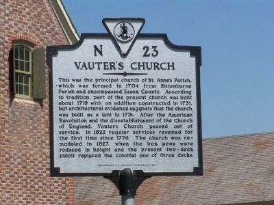
Vauter's Church
Erected 1993 by Department of Historic Resources. (Marker Number N-23.)
Topics and series. This historical marker is listed in these topic lists: Churches & Religion • Colonial Era • War, US Revolutionary. In addition, it is included in the Virginia Department of Historic Resources (DHR) series list. A significant historical year for this entry is 1704.
Location. 38° 5.205′ N, 77° 4.127′ W. Marker is in Loretto, Virginia, in Essex County. Marker is on US 17 north of Spindle Shop Road, on the right when traveling north. Touch for map. Marker is in this post office area: Loretto VA 22509, United States of America. Touch for directions.
Other nearby markers. At least 8 other markers are within 4 miles of this marker, measured as the crow flies. Portobacco Indians (approx. 1.1 miles away); Saunders’s Wharf (approx. 1.8 miles away); Layton’s Landing Wharf and Ferry (approx. 3½ miles away); Early Settlement (approx. 3½ miles away); Essex County / Caroline County (approx. 3.6 miles away); Pissaseck Indians (approx. 3.8 miles away); Leedstown (approx. 3.9 miles away); John Pratt Hungerford (approx. 3.9 miles away).
Also see . . . On the Road in Essex County - N-23 Vauter’s Church. 2019 article by Zorine Shirley in the River Country News. Excerpt:
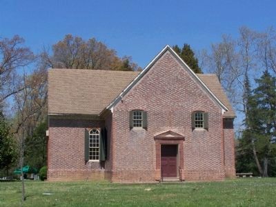
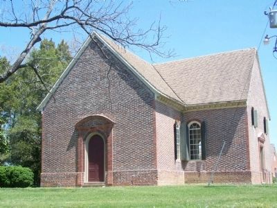
The “T” or “cruciform” shape of the building makes it rather unusual for the time. The brick pattern is known as Flemish bond. Each course or layer of brick contains alternating ‘stretchers’ (the long end of the brick) and ‘headers’ (the short end of the brick). Flemish bond became the pattern of choice for masonry in the early 1700’s replacing the English bond of the 1600’s.(Submitted on September 17, 2020.)
Credits. This page was last revised on September 17, 2020. It was originally submitted on April 27, 2008, by Bill Pfingsten of Bel Air, Maryland. This page has been viewed 2,813 times since then and 55 times this year. Photos: 1, 2, 3, 4. submitted on April 27, 2008, by Bill Pfingsten of Bel Air, Maryland.


