Near Spotsylvania Courthouse in Spotsylvania County, Virginia — The American South (Mid-Atlantic)
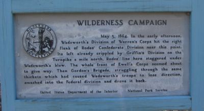
Wilderness Campaign
Erected by United States Department of the Interior - National Park Service.
Topics. This historical marker is listed in this topic list: War, US Civil. A significant historical date for this entry is May 5, 1704.
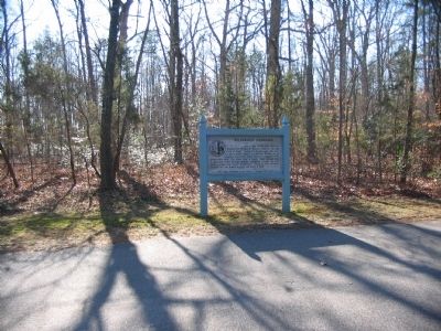
Location. 38° 18.265′ N, 77° 44.839′ W. Marker is near Spotsylvania Courthouse, Virginia, in Spotsylvania County. Marker is on Hill Ewell Drive, on the right when traveling south. Located between stops four (Higgerson Farm) and five (Chewning Farm) on the driving tour of the Wilderness Battlefield. Touch for map. Marker is at or near this postal address: 13012 Hill Ewell Dr, Spotsylvania VA 22551, United States of America. Touch for directions.
Other nearby markers. At least 8 other markers are within one mile of this marker, measured as the crow flies. The Higgerson Farm (approx. 0.3 miles away); The Chewning Farm (approx. 0.6 miles away); a different marker also named Wilderness Campaign (approx. 0.6 miles away); Key Terrain (approx. 0.8 miles away); A.P. Hill Escapes Capture (approx. 0.8 miles away); "A Wild, Wicked Roar" (approx. one mile away); Saunders Field (approx. one mile away); The Capture of Winslow's Battery (approx. one mile away). Touch for a list and map of all markers in Spotsylvania Courthouse.
Related markers. Click here for a list of markers that are related to this marker. Wilderness Campaign Happel Markers
Also see . . . Wilderness Battlefield. National Park Service page. (Submitted on April 27, 2008, by Craig Swain of Leesburg, Virginia.)
Credits. This page was last revised on July 9, 2021. It was originally submitted on April 27, 2008, by Craig Swain of Leesburg, Virginia. This page has been viewed 1,199 times since then and 24 times this year. It was the Marker of the Week May 4, 2014. Photos: 1, 2. submitted on April 27, 2008, by Craig Swain of Leesburg, Virginia.

