Williamsburg in Whitley County, Kentucky — The American South (East South Central)
County Named, 1818
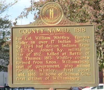
Photographed by Don Morfe, April 17, 2014
1. County Named, 1818 Marker
Erected 1967 by Kentucky Historical Society-Kentucky Department of Highways. (Marker Number 1067.)
Topics and series. This memorial is listed in these topic lists: Settlements & Settlers • War of 1812 • Wars, US Indian. In addition, it is included in the Kentucky Historical Society series list. A significant historical year for this entry is 1794.
Location. 36° 44.622′ N, 84° 9.588′ W. Memorial is in Williamsburg, Kentucky, in Whitley County. It is on N 2nd Street. The marker is located on the grounds of the Whitley County Courthouse. Touch for map. Memorial is in this post office area: Williamsburg KY 40769, United States of America. Touch for directions.

Regionally, this memorial is in Eastern Kentucky and in the Cumberland Plateau. It is also in the American
this page online
Other nearby markers. At least 8 other markers are within 2 miles of this marker, measured as the crow flies: Scott's Raid (a few steps from this marker); "Aunt Julia" Marcum (within shouting distance of this marker); Samuel Cox, 1756-1832 (about 300 feet away, measured in a direct line); Clyde V. and Patricia Bennett Building (approx. 0.4 miles away); Roburn Hall (approx. half a mile away); Cumberland College (approx. 0.6 miles away); Roy Martis Chappell (approx. 0.9 miles away); Historic Williamsburg (approx. 1.3 miles away). Touch for a list and map of all markers in Williamsburg.
Other markers no longer nearby. Mahan Hall (was approx. 0.4 miles away but has been confirmed missing); Gillespie Hall (was approx. half a mile away but has been confirmed missing).
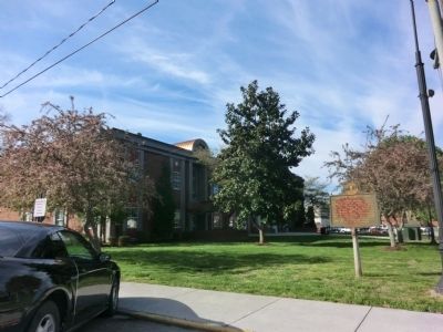
Photographed by Don Morfe, April 17, 2014
2. County Named, 1818 Marker
Credits. This page was last revised on June 16, 2016. It was originally submitted on June 3, 2014, by Don Morfe of Baltimore, Maryland. This page has been viewed 913 times since then and 36 times this year. Photos: 1, 2. submitted on June 3, 2014, by Don Morfe of Baltimore, Maryland. • Bill Pfingsten was the editor who published this page.
