Near Cloverdale in Owen County, Indiana — The American Midwest (Great Lakes)
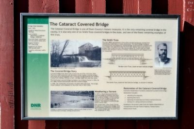
The Cataract Covered Bridge
Photographed by Duane Hall, May 23, 2014
1. The Cataract Covered Bridge Marker
The Covered Bridge Story
Covered bridges have been built around the world for centuries. With America’s rapid expansion and abundant timber supply, covered bridges were built at an unsurpassed rate. Covering a bridge protects the wooden trusses from rotting. Without a roof, a bridge might last only four years.
The first known covered bridge in Indiana was in Henry County in 1834. By the 1880s Indiana had between 400-500 covered bridges.
In 1876, the community of Cataract includes mills and shops. The bridge linked Cataract with residents on the other side of Mill Creek.
The Smith Truss
The late 1800s represented a time when manufacturing was moving from individually made items to mass production. The Smith Bridge Company introduced new techniques for covered bridge construction to compete with iron bridges that appeared after the Civil War. Rather than build
this page online
Weathering a Torrent
In 1875, a flood destroyed the first covered bridge at Cataract and more than a dozen bridges in Owen County. One of the few bridges to survive the flood was the covered bridge at Gosport. The Gosport Covered Bridge used a Smith Truss.
One month later, when Owen County let bids for a replacement bridge, their advertisement requested a Smith Truss. The current bridge with its Smith Truss was completed in 1876.
Restoration of the Cataract Covered Bridge
Extensive rehabilitation has been conducted to preserve the bridge. Restoration included:
- rebuilding the wingwalls
- repairing abutment
- replacing and repairing truss timbers and lateral braces
- redoing trim, siding and historical details
Bridge Vital Statistics:
- Built: 1876
- Length of Wood Structure: 148 feet
- Cost to Building: Abutments, $1678.84; Bridge, $2009.00
- MaterialsUsed: Limestone and non-native white pine
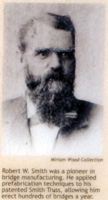 Photographed by Duane Hall, May 23, 20142. Close-up of Right Image on Marker
Caption: Robert W. Smith was a pioneer in bridge manufacturing. He applied prefabrication techniques to his patented Smith Truss, allowing him erect hundreds of bridges a year. - Biggest Timbers: 33 ½ feet long
- Weight of cut stones: 4000 pounds each
- Closed to vehicular traffic: 1988
Erected by Indiana Department of Natural Resources.
Topics and series. This historical marker is listed in these topic lists: Bridges & Viaducts • Industry & Commerce. In addition, it is included in the Covered Bridges series list. A significant historical year for this entry is 1834.
Location. 39° 26.01′ N, 86° 48.809′ W. Marker is near Cloverdale, Indiana, in Owen County. It can be reached from the intersection of N. Cataract Road and Owen Park Road. Marker and covered bridge are located in Cataract Falls unit of the Lieber State Recreation Area; the above directions are to the main entrance to the Cataract Falls unit. Touch for map. Marker is in this post office area: Poland IN 47868, United States of America. Touch for directions.

Regionally, this marker is in Central Indiana. It is also in the American Midwest and in the Corn Belt. Globally, it is in North America, the Western Hemisphere, the Western World, and the Anglosphere. Historically, it finds itself in what
Photographed by Duane Hall, May 23, 2014
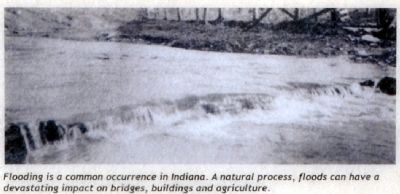
3. Close-up of Lower Left Image on Marker
Other nearby markers. At least 8 other markers are within 11 miles of this marker, measured as the crow flies: Cataract Falls Covered Bridge (within shouting distance of this marker); The Ten O'Clock Line (approx. 9½ miles away); Camp Hughes (approx. 9½ miles away); Putnamville United Methodist Church (approx. 10.1 miles away); Putnamville (approx. 10.1 miles away); Ferry Bridge (approx. 10.1 miles away); The Cumberland Road · The National Road · U.S. Highway 40 (approx. 10.1 miles away); Putnamville School (approx. 10.1 miles away). Touch for a list and map of all markers in Cloverdale.
Another marker is no longer nearby. Cataract Falls (was about 500 feet away, measured in a direct line but has been confirmed missing).
Photographed by Duane Hall, May 23, 2014
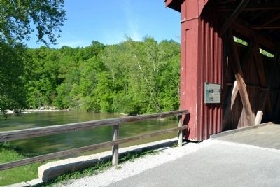
4. Marker in Cataract Covered Bridge
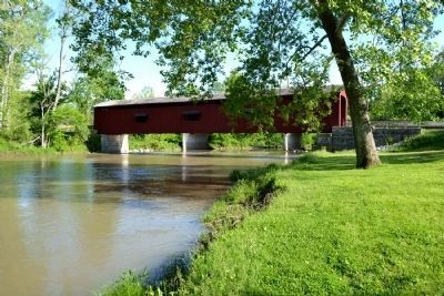
Photographed by Duane Hall, May 23, 2014
5. Cataract Covered Bridge
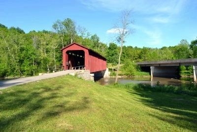
Photographed by Duane Hall, May 23, 2014
6. Cataract Covered Bridge
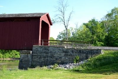
Photographed by Duane Hall, May 23, 2014
7. Stone Abutment of West Landing of Bridge
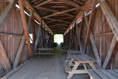
Photographed by Duane Hall, May 23, 2014
8. Interior of Cataract Covered Bridge
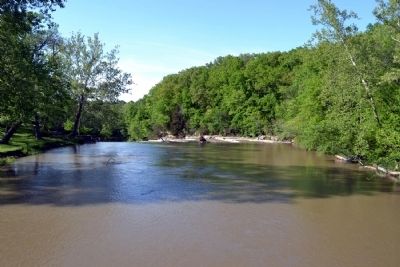
Photographed by Duane Hall, May 23, 2014
9. Mill Creek Above Upper Cataract Falls
Credits. This page was last revised on November 15, 2024. It was originally submitted on June 4, 2014, by Duane Hall of Abilene, Texas. This page has been viewed 1,120 times since then and 32 times this year. Photos: 1, 2, 3, 4, 5, 6, 7, 8, 9. submitted on June 4, 2014, by Duane Hall of Abilene, Texas.
