Caryville in Campbell County, Tennessee — The American South (East South Central)
Stone Mill
circa 1900-1934
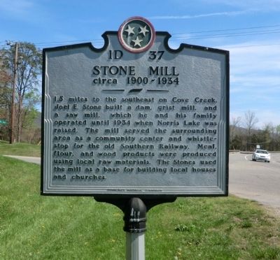
Photographed by Don Morfe, April 17, 2014
1. Stone Mill Marker
Erected by Tennessee Historical Commission. (Marker Number 1D 37.)
Topics and series. This historical marker is listed in these topic lists: Industry & Commerce • Settlements & Settlers. In addition, it is included in the Tennessee Historical Commission series list. A significant historical year for this entry is 1934.
Location. 36° 18.582′ N, 84° 12.648′ W. Marker is in Caryville, Tennessee, in Campbell County. It is at the intersection of Veterans Memorial Highway (US 25W) and Park Road on Veterans Memorial Highway (US 25W). Touch for map. Marker is in this post office area: Caryville TN 37714, United States of America. Touch for directions.

Regionally, this marker is in East Tennessee and in
this page online
Other nearby markers. At least 8 other markers are within 7 miles of this marker, measured as the crow flies: The Civilian Conservation Corps and Cove Lake State Park (about 300 feet away, measured in a direct line); Indian Mounds (approx. 0.4 miles away); Campbell County War Memorial (approx. 2.1 miles away); Dean Dillon (approx. 6.9 miles away); Ghosts of Convict Miners (approx. 7 miles away); Fort Anderson (approx. 7 miles away); Why Miners Fought (approx. 7 miles away); Coal Creek War (approx. 7 miles away).
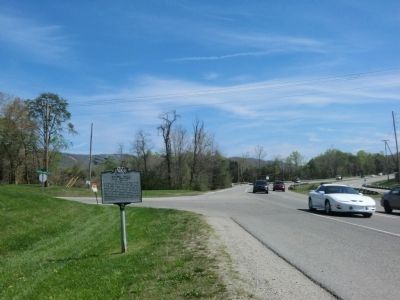
Photographed by Don Morfe, April 17, 2014
2. Stone Mill Marker
Credits. This page was last revised on June 16, 2016. It was originally submitted on June 7, 2014, by Don Morfe of Baltimore, Maryland. This page has been viewed 1,208 times since then and 43 times this year. Last updated on June 8, 2014, by Byron Hooks of Sandy Springs, Georgia. Photos: 1, 2. submitted on June 7, 2014, by Don Morfe of Baltimore, Maryland. • Bill Pfingsten was the editor who published this page.
