Bardstown in Nelson County, Kentucky — The American South (East South Central)
Bardstown
Side A
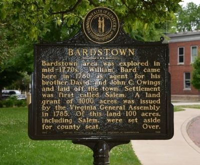
Bardstown area was explored in mid-1770s. William Bard came here in 1780 as agent for his brother David, and John C. Owings and laid off the town. Settlement was first called Salem. A land grant of 1000 acres was issued by the Virginia General Assembly in 1785. Of this land 100 acres, including Salem, were set aside for county seat.
Side B
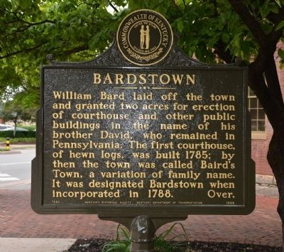
William Bard laid off the town and granted two acres for erection of courthouse and other public buildings in the name of his brother David, who remained in Pennsylvania. The first courthouse, of hewn logs, was built 1785; by then the town was called Baird's Town, a variation of family name. It was designated Bardstown when incorporated in 1788.
Erected 1980 by The Kentucky Historical Society & The Kentucky Department of Transportation. (Marker Number 1668.)
Topics and series. This historical marker is listed in these topic lists: Colonial Era • Settlements & Settlers. In addition, it is included in the Kentucky Historical Society series list. A significant historical year for this entry is 1780.
Location. 37° 48.534′ N, 85° 27.99′ W. Marker is in Bardstown, Kentucky, in Nelson County. Marker is on East Stephen Foster Avenue. Marker is in the Southeast quadrant of the town square (or town circle), between South 3rd Street and East Stephen Foster Avenue. Touch for map. Marker is at or near this postal address: 103 East Stephen Foster Avenue, Bardstown KY 40004, United States of America. Touch for directions.
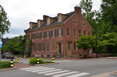
Other nearby markers. At least 8 other markers are within walking distance of this marker. McLean House (here, next to this marker); Nelson Countians who served and Gave All (a few steps from this marker); Nelson County World War I, World War II, Korean War, & Vietnam War Memorial (within shouting distance of this marker); Vietnam 1969 Memorial (within shouting distance of this marker); a different marker also named Nelson Countians who served and Gave All (within shouting distance of this marker); The Harrison-Smith House (within shouting distance of this marker); County Named, 1784 (within shouting distance of this marker); John Fitch Memorial (within shouting distance of this marker). Touch for a list and map of all markers in Bardstown.
Credits. This page was last revised on June 16, 2016. It was originally submitted on June 9, 2014, by Karl Stelly of Gettysburg, Pennsylvania. This page has been viewed 959 times since then and 71 times this year. Photos: 1, 2, 3. submitted on June 9, 2014, by Karl Stelly of Gettysburg, Pennsylvania. • Bill Pfingsten was the editor who published this page.


