Talbot's Corner in Nashville in Davidson County, Tennessee — The American South (East South Central)
Heaton's Station
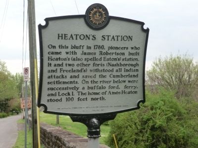
Photographed by Don Morfe, April 18, 2014
1. Heaton's Station Marker
Erected 1967 by The Historical Commission of Metropolitan Nashville and Davidson County. (Marker Number 1.)
Topics and series. This memorial is listed in these topic lists: Forts and Castles • Settlements & Settlers. In addition, it is included in the Tennessee, The Historical Commission of Metropolitan Nashville and Davidson County series list. A significant historical year for this entry is 1780.
Location. 36° 12′ N, 86° 47.25′ W. Memorial is in Nashville, Tennessee, in Davidson County. It is in Talbot's Corner. It is on Lock Road. Touch for map. Memorial is in this post office area: Nashville TN 37207, United States of America. Touch for directions.

Regionally, this memorial is in Middle Tennessee. It is also in the American South and specifically in the Upper South.
this page online
Other nearby markers. At least 8 other markers are within 2 miles of this marker, measured as the crow flies: A different marker also named Heaton's Station (about 500 feet away, measured in a direct line); Griggs Hall (approx. ¼ mile away); The Nashville Race Course (approx. half a mile away); Randall "Randy" Walter Parham (approx. half a mile away); Riverside Sanitarium and Hospital / Dorothy Lavinia Brown, M.D. (approx. 0.6 miles away); Haynes High School (approx. 0.6 miles away); "Historic Talbot's Corner" / Thomas Talbot 1760-1831 (approx. 0.7 miles away); Samuel Watkins (approx. 1.1 miles away). Touch for a list and map of all markers in Nashville.
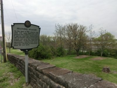
Photographed by Don Morfe, April 18, 2014
2. Heaton's Station Marker
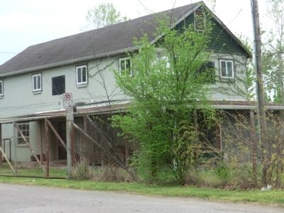
Photographed by Don Morfe, April 18, 2014
3. Heaton's Station Marker
Credits. This page was last revised on February 7, 2023. It was originally submitted on June 11, 2014, by Don Morfe of Baltimore, Maryland. This page has been viewed 2,711 times since then and 116 times this year. Photos: 1, 2, 3. submitted on June 11, 2014, by Don Morfe of Baltimore, Maryland. • Bill Pfingsten was the editor who published this page.
