Bullskin Township near Wooddale in Fayette County, Pennsylvania — The American Northeast (Mid-Atlantic)
Ore Mines Drill
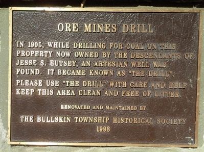
Photographed by Jay Stern, March 14, 2014
1. Ore Mines Drill Marker
Erected 1998 by The Bullskin Township Historical Society.
Topics. This historical marker is listed in this topic list: Landmarks. A significant historical year for this entry is 1905.
Location. 40° 5.689′ N, 79° 30.878′ W. Marker is near Wooddale, Pennsylvania, in Fayette County. It is in Bullskin Township. It is at the intersection of Ore Mine Hill Road and Park Road, on the left when traveling east on Ore Mine Hill Road. Although the town of Scottdale, PA is located in Westmoreland County, this marker resides in the village of Wooddale, Bullskin Township, Fayette County, 0.4 miles east of PA Route 982. Touch for map. Marker is in this post office area: Scottdale PA 15683, United States of America. Touch for directions.

Regionally, this marker is in the Laurel Highlands. It is also in the American Northeast,
this page online
Other nearby markers. At least 8 other markers are within 4 miles of this marker, measured as the crow flies: Bullskin Township Honor Roll (approx. ¼ mile away); Bullskin Veterans Memorial (approx. ¼ mile away); Mount Vernon Iron Furnace (approx. ¼ mile away); The Mount Vernon Furnace (approx. ¼ mile away); Braddock's Military Road 1755 Great Swamp Camp (approx. 1.7 miles away); Henry Clay Frick (approx. 3 miles away); Beehive Coke Oven (approx. 3.1 miles away); West Overton Historical House (approx. 3.1 miles away). Touch for a list and map of all markers in Wooddale.
More about this marker. On Park Road, on the left, 0.25 miles to the ENE of this plaque (0.4 driving miles) is the large, restored and well maintained, and public accessible late 18th-early 19th century cut stone Mount Vernon
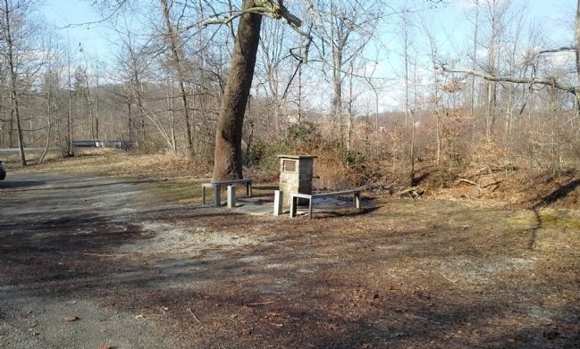
Photographed by Jay Stern, March 14, 2014
2. Ore Mines Drill facing north
Regarding Ore Mines Drill. This is a flowing artesian well. The water is excellent.
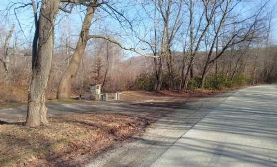
Photographed by Jay Stern, March 14, 2014
3. Ore Mines Drill facing SE
Credits. This page was last revised on July 14, 2025. It was originally submitted on March 15, 2014, by Jay Stern of Connellsville, Pennsylvania. This page has been viewed 1,271 times since then and 74 times this year. Last updated on June 13, 2014, by Jay Stern of Connellsville, Pennsylvania. Photos: 1, 2, 3. submitted on March 15, 2014, by Jay Stern of Connellsville, Pennsylvania. • Bill Pfingsten was the editor who published this page.
