McEwen in Humphreys County, Tennessee — The American South (East South Central)
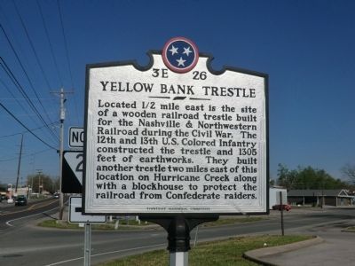
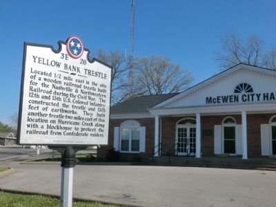
Yellow Bank Trestle
Erected by Tennessee Historical Commission. (Marker Number 3E 26.)
Topics and series. This historical marker is listed in these topic lists: African Americans • Bridges & Viaducts • War, US Civil. In addition, it is included in the Tennessee Historical Commission series list. A significant historical year for this entry is 1305.
Location. 36° 6.45′ N, 87° 38.016′ W. Marker is in McEwen, Tennessee, in Humphreys County. Marker is at the intersection of Broadway of America HIghway (US 70 and Bold Springs Road (SR 933) on Broadway of America HIghway (US 70. Touch for map. Marker is in this post office area: Mc Ewen TN 37101, United States of America. Touch for directions.
Other nearby markers. At least 8 other markers are within 9 miles of this marker, measured as the crow flies. Enochs Grist Mill (approx. 3.6 miles away); Enochs Mill (approx. 3.6 miles away); Camp Gillem (approx. 6.7 miles away); Irish Shanty (approx. 6.7 miles away); Civil War on Yellow Creek (approx. 7.7 miles away); “Maple Drive” (approx. 8.4 miles away); Porch-Reed School (approx. 8.9 miles away); Waverly Disaster (approx. 9 miles away). Touch for a list and map of all markers in McEwen.
Credits. This page was last revised on January 20, 2020. It was originally submitted on June 13, 2014, by Don Morfe of Baltimore, Maryland. This page has been viewed 824 times since then and 47 times this year. Photos: 1, 2. submitted on June 13, 2014, by Don Morfe of Baltimore, Maryland. • Bill Pfingsten was the editor who published this page.

