Florence in Lauderdale County, Alabama — The American South (East South Central)
Veterans Memorial Park
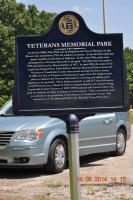
Photographed by Sandra Hughes, June 14, 2014
1. Veterans Memorial Park Marker
Erected 2014 by Florence Historical Board.
Topics. This historical marker is listed in this topic list: Notable Places. A significant historical month for this entry is April 1983.
Location. 34° 48.859′ N, 87° 37.601′ W. Marker is in Florence, Alabama, in Lauderdale County. It is at the intersection of Veterans Park Drive and South Cox Creek Parkway (Alabama Route 133), on the left when traveling south on Veterans Park Drive. Touch for map. Marker is in this post office area: Florence AL 35630, United States of America. Touch for directions.

Regionally, this marker is in North Alabama and in the Shoals. It is also in the American South, specifically in the Deep South, in Appalachia, and specifically in Southern Appalachia. Globally,
this page online
Other nearby markers. At least 8 other markers are within walking distance of this marker: The Phantom (approx. 0.2 miles away); Lieutenant Colonel R. Edward Yeilding (approx. 0.2 miles away); The Cobra Helicopter (approx. 0.2 miles away); 75mm Field Gun (approx. 0.2 miles away); Global War on Terrorism (approx. 0.2 miles away); Anti-Tank Gun (approx. 0.2 miles away); “Gooney Bird” Propeller (approx. 0.2 miles away); Don Leslie Michael (approx. ¼ mile away). Touch for a list and map of all markers in Florence.
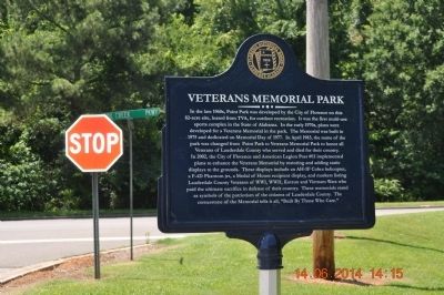
Photographed by Sandra Hughes, June 14, 2014
2. Veterans Memorial Park Marker
Credits. This page was last revised on June 16, 2016. It was originally submitted on June 14, 2014, by Sandra Hughes Tidwell of Killen, Alabama, USA. This page has been viewed 1,241 times since then and 42 times this year. Photos: 1, 2. submitted on June 14, 2014, by Sandra Hughes Tidwell of Killen, Alabama, USA. • Bernard Fisher was the editor who published this page.
