Bellefontaine in Logan County, Ohio — The American Midwest (Great Lakes)
Myeerah Trail / Historic Logan County
— The Second Marker at the other end of the trail —
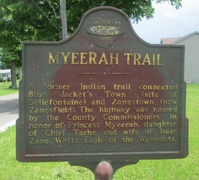
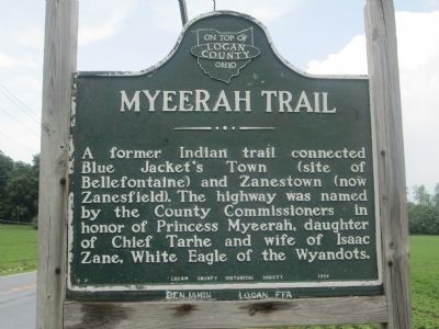
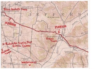
A former Indian trail connected Blue Jacket's Town (site of Bellefontaine) and Zanestown (now Zanesfield). The highway was named by the County Commissioners in honor of Princess Myreerah, daughter of Chief Tarhe and wife of Isaac Zane, White Eagle of the Wyandots.
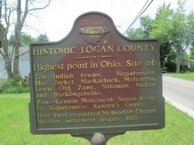
Highest point in Ohio. Site of: Ten Indian towns: Wapatomica, Blue Jacket, Mackachack, Moluntha, Lewis, Old, Zane, Solomon, McKee and Buckongehelas. Zane-Kenton Monument: Squaw Rock; Ft. Wapatomica; Kenton's Grave. Here first organized Methodist Church Mission movement began, 1819.
Erected 1954 by Logan County Historical Society.
Topics. This historical marker is listed in these topic lists: Native Americans • Settlements & Settlers. A significant historical year for this entry is 1819.
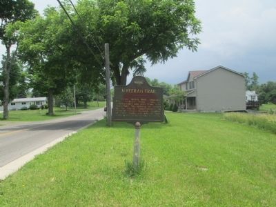
Location. 40° 21.335′ N, 83° 44.391′ W. Marker is in Bellefontaine, Ohio, in Logan County. Marker is at the intersection of Eastern Avenue (County Route 10) and Organ Street, on the right when traveling east on Eastern Avenue. there are TWO identical markers, one at each end of this section of road, the one at Zanesfield is already in the HMDB. This one is at the east edge of Bellefontaine, Ohio. Touch for map . Marker is at or near this postal address: 908 Eastern Avenue, Bellefontaine OH 43311, United States of America. Touch for directions.
Other nearby markers. At least 8 other markers are within one mile of this marker, measured as the crow flies. Bellefontaine (approx. 0.9 miles away); Bellefontaine High School Veterans Memorial (approx. 0.9 miles away); Bellefontaine Vietnam Memorial (approx. 0.9 miles away); Bellefontaine War Memorial (approx. one mile away); The Harley Long Building (approx. one mile away); The Mills Brothers (approx. one mile away); The Bellefontaine Examiner (approx. one mile away); Congressional Medal of Honor Recipients (approx. 1.1 miles away). Touch for a list and map of all markers in Bellefontaine.
More about this marker. this historic road; the Myeerah Trail, is Eastern Avenue, and Columbus Avenue in Bellefontaine. At the city limits it becomes Logan County Road 10. It is also known as the Zanesfield Pike, and was also referred to as the Columbus Road. It has long since been replaced by US 33.
Regarding Myeerah Trail / Historic Logan County. The trail arrives in Zanesfield from the southeast, ultimately from Chillicothe, up Darby Creek. It continues northwest out of Bellefontiane as Garfield Avenue, running as "the OLD ROAD", to Manary's Blockhouse and Buckingehalis' Town, where it forks, with one side going on to Lewistown and Ft. Wayne, with the other side going to Detroit or Sandusky, by way of Solomon Town.
Additional keywords. multiple Indian Villages
Credits. This page was last revised on June 16, 2016. It was originally submitted on June 17, 2014, by Rev. Ronald Irick of West Liberty, Ohio. This page has been viewed 1,170 times since then and 61 times this year. Photos: 1, 2, 3, 4, 5. submitted on June 17, 2014, by Rev. Ronald Irick of West Liberty, Ohio. • Bill Pfingsten was the editor who published this page.
