Near Stanbridge East in Brome-Missisquoi, Québec — Central Canada (French-Canadian)
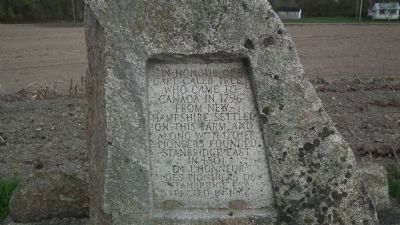
In honour of Capt. Caleb Tree
Erected 1966.
Topics. This historical marker is listed in these topic lists: Agriculture • Settlements & Settlers. A significant historical year for this entry is 1796.
Location. 45° 7.023′ N, 72° 55′ W. Marker is near Stanbridge East, Québec, in Brome-Missisquoi. Marker is on Chemin Gage, 0.1 kilometers south of Québec Route 202, on the right when traveling north. Touch for map. Marker is in this post office area: Stanbridge East QC J0J 2H0, Canada. Touch for directions.
Other nearby markers. At least 6 other markers are within 27 kilometers of this marker, measured as the crow flies. Grange Alexander-Solomon-Walbridge (approx. 6.8 kilometers away); First Women's Institute (approx. 9.3 kilometers away); Battle of Eccles Hill (approx. 10.9 kilometers away); Saxe's Mills (approx. 18 kilometers away in the U.S.); Highgate Falls Lenticular Truss Bridge (approx. 22.9 kilometers away in the U.S.); Missisquoi Village and Mission (approx. 25.9 kilometers away in the U.S.).
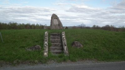
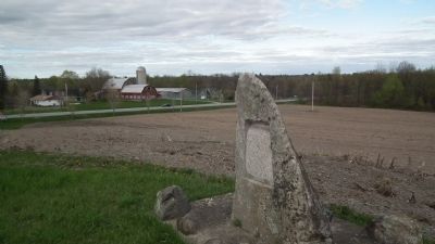
More about this marker. On the highest point just outside the village of Stanbridge East, this marker sits alone next to a field. The inscription used to be on a plaque, but when the plaque was stolen, it was carved into the marker.
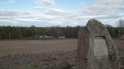
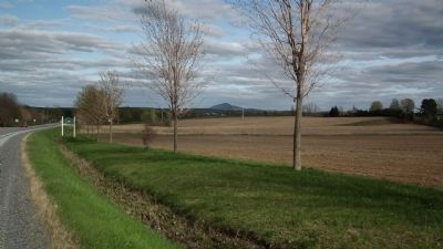
The nearby Pike River flows nearby. Just down the hill in the village is the Missisquoi Historical Society Museum. Off in the distance, one can see Pinnacle mountain as well as the Sutton mountain range and on a clear day, Jay Peak in Vermont is visible.
Regarding In honour of Capt. Caleb Tree. A shaft of grey field stone sits atop a hill on the farm of K.D. Tree, just outside the village of Stanbridge East.
Land on which to place this cairn was given to the Missisquoi County Historical Society by K.D. Tree, the Society erected the cairn, and the flight of concrete steps leading to it from the road. Mr. Tree and other friends defrayed the cost of the plaque. Mr. Tree and Mr. Crellar did the necessary work.
It was unveiled on October 15th, 1966 by two great-great grandsons of Caleb Tree.
The cairn was covered with two flags, the Union Jack under which the early settlers lived and under which many of their descendants from Stanbridge East gave their services and in some cases their lives, in both World Wars; and our new Canadian flag.
This grey stone on the highest point of land in Stanbridge Township typifies the strength, vigor and daring of these early pioneers who came into this vicinity when all the land was covered with forests, and with back-breaking labour cleared the land and made homes for their families.
-Text taken from Missisquoi Historical Society Reports, Vol. 9, page 128.-
Credits. This page was last revised on June 16, 2016. It was originally submitted on May 10, 2011, by Kevin Craft of Bedford, Quebec. This page has been viewed 851 times since then and 17 times this year. Last updated on June 18, 2014, by Kevin Craft of Bedford, Quebec. Photos: 1, 2, 3, 4, 5. submitted on May 10, 2011, by Kevin Craft of Bedford, Quebec. • Bill Pfingsten was the editor who published this page.
