White Stone in Lancaster County, Virginia — The American South (Mid-Atlantic)
The War of 1812 / Capture of the Dolphin
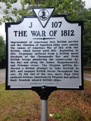
The War of 1812. Impressment of Americans into British service and the violation of American ships were among the causes of America's War of 1812 with the British which lasted until 1815. Virginians suffered from a British naval blockade of the Chesapeake Bay and from British troops plundering the countryside by the Bay and along the James, Rapahannock, and Potomac Rivers. That Virginia militia deflected a British attempt to take Norfolk in 1813, and engaged British forces throughout the war. By the end of the war, more than 2000 enslaved African Americans in Virginia and gained their freedom aboard British ships.
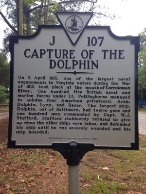
Capture of the Dolphin. On 3 April 1813, one of the largest naval engagements in Virginia waters during the War of 1812 took place at the mouth of the Corrotoman River. One hundred five British naval and marine forces under Lt. Polkinghorne managed to subdue four American privateers: Arab, Dolphin, Lynx, and Racer. The largest ship, Dolphin, out of Baltimore, had twelve guns and one hundred men commanded by Capt. W.J. Stafford. Stafford stubbornly refused to give up when the other ships were taken, and defended his ship until he was severely wounded and his ship boarded.
Erected 2013 by Department of Historic Resources. (Marker Number J-107.)
Topics and series. This historical marker is listed in these topic lists: Military • War of 1812. In addition, it is included in the Virginia Department of Historic Resources (DHR) series list. A significant historical date for this entry is April 3, 1813.
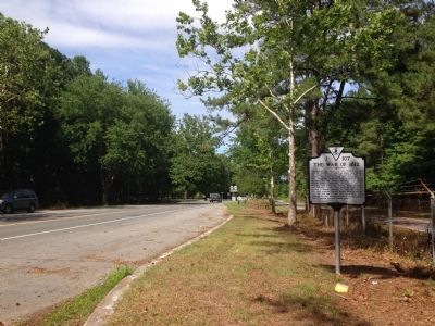
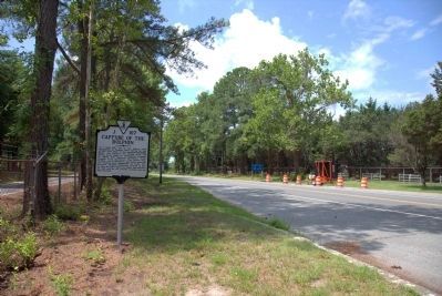
Location. 37° 38.285′ N, 76° 24.541′ W. Marker is in White Stone, Virginia, in Lancaster County. Marker is on Mary Ball Road (Virginia Route 3) just north of the Robert O. Norris Jr. Bridge, on the right when traveling north. Touch for map. Marker is in this post office area: White Stone VA 22578, United States of America. Touch for directions.
Other nearby markers. At least 8 other markers are within 3 miles of this marker, measured as the crow flies. 69 Slaves Escape to Freedom (a few steps from this marker); Albert Terry Wright (approx. 0.6 miles away); A. T. Wright High School (approx. 0.7 miles away); Irvington World War I Memorial (approx. 1.7 miles away); Site of Robert Carter's Brick Kiln (approx. 3 miles away); Foundation for Historic Christ Church, Inc. (approx. 3 miles away); Virginia Founders, Revolutionary War Patriots and War of 1812 Veterans (approx. 3 miles away); Christ Church Lancaster (approx. 3 miles away). Touch for a list and map of all markers in White Stone.
More about this marker. While the date on the marker is 2010, it was not installed until December 2013. There is a short parking area along both sides of the roadway.
Also see . . . Historical societies to dedicate Lancaster’s War of 1812 marker. This article appeared in the online version of the Rappahannock Record, shortly before the marker was dedicated. (Submitted on June 23, 2014, by Kevin W. of Stafford, Virginia.)
Credits. This page was last revised on July 7, 2021. It was originally submitted on June 21, 2014, by Kevin W. of Stafford, Virginia. This page has been viewed 731 times since then and 28 times this year. Photos: 1, 2. submitted on June 21, 2014, by Kevin W. of Stafford, Virginia. 3. submitted on June 23, 2014, by Kevin W. of Stafford, Virginia. 4. submitted on July 27, 2014, by J. J. Prats of Powell, Ohio.


