Mathews in Mathews County, Virginia — The American South (Mid-Atlantic)
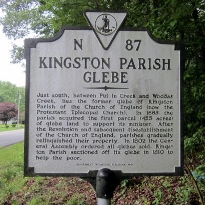
Kingston Parish Glebe
Erected 1991 by Department of Historic Resources. (Marker Number N-87.)
Topics and series. This historical marker is listed in these topic lists: Churches & Religion • Colonial Era. In addition, it is included in the Virginia Department of Historic Resources (DHR) series list. A significant historical year for this entry is 1665.
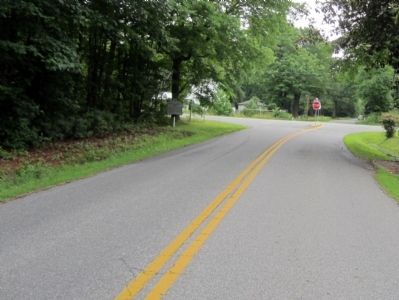
Location. 37° 26.432′ N, 76° 20.129′ W. Marker is in Mathews, Virginia, in Mathews County. Marker is at the intersection of Glebe Road (Virginia Route 621) and Church Street (Virginia Route 611), on the right when traveling south on Glebe Road. Touch for map. Marker is in this post office area: Mathews VA 23109, United States of America. Touch for directions.
Other nearby markers. At least 8 other markers are within walking distance of this marker. Thomas Hunter (Rosenwald) School (approx. 0.6 miles away); Veterans Memorial (approx. 0.7 miles away); Mathews County Courthouse Square (approx. 0.9 miles away); Captain Sally L. Tompkins, C.S.A. (approx. 0.9 miles away); Mathews County Confederate Monument (approx. 0.9 miles away); Civil War In Mathews County (approx. 0.9 miles away); Fort Cricket Hill (approx. 0.9 miles away); Tompkins Cottage Museum (approx. 0.9 miles away). Touch for a list and map of all markers in Mathews.
Credits. This page was last revised on June 16, 2016. It was originally submitted on June 22, 2014, by Bernard Fisher of Richmond, Virginia. This page has been viewed 527 times since then and 31 times this year. Photos: 1, 2. submitted on June 22, 2014, by Bernard Fisher of Richmond, Virginia.

