Morristown in Morris County, New Jersey — The American Northeast (Mid-Atlantic)
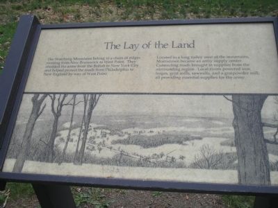
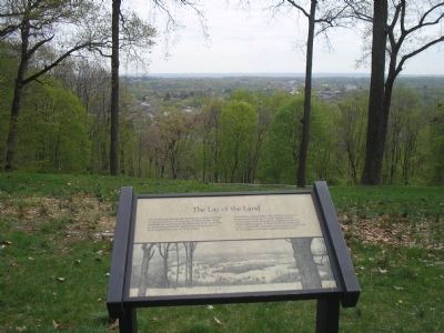
The Lay of the Land
Located in a long valley west of the mountains, Morristown became an army supply center. Connecting roads brought in supplies from the surrounding region. Local rivers powered iron forges, grist mills, sawmills, and a gunpowder mill; all providing essential supplies for the army.
Erected by Morristown National Historical Park.
Topics. This historical marker is listed in these topic lists: Forts and Castles • Military • Notable Places • War, US Revolutionary.
Location. 40° 47.636′ N, 74° 29.27′ W. Marker is in Morristown, New Jersey, in Morris County. Marker can be reached from Chestnut Street, on the left when traveling west. Marker is in Morristown National Historical Park, in the Fort Nonsense section, off Chestnut Street. Touch for map. Marker is in this post office area: Morristown NJ 07960, United States of America. Touch for directions.
Other nearby markers. At least 8 other markers are within walking distance of this marker. Morristown (here, next to this marker); The Upper Redoubt (a few steps from this marker); Fort Nonsense (a few steps from this marker); a different marker also named Fort Nonsense (within shouting distance of this marker); Iron (within shouting distance of this marker); The Alarm Beacon (within shouting distance of this marker); Chain of Signal Beacons (within shouting distance of this marker); Mt. Kemble Home (approx. 0.2 miles away). Touch for a list and map of all markers in Morristown.
Also see . . . Fort Nonsense. Morristown National Historical Park. (Submitted on April 30, 2008, by Bill Coughlin of Woodland Park, New Jersey.)
Credits. This page was last revised on June 16, 2016. It was originally submitted on April 30, 2008, by Bill Coughlin of Woodland Park, New Jersey. This page has been viewed 1,092 times since then and 20 times this year. Photos: 1, 2, 3, 4. submitted on April 30, 2008, by Bill Coughlin of Woodland Park, New Jersey. • Kevin W. was the editor who published this page.


