Columbia in Maury County, Tennessee — The American South (East South Central)
Billy Direct
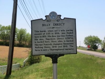
Photographed by Don Morfe, April 23, 2014
1. Billy Direct Marker
Erected by Tennessee Historical Commission. (Marker Number 3D 47.)
Topics and series. This historical marker is listed in this topic list: Animals. In addition, it is included in the Tennessee Historical Commission series list. A significant historical year for this entry is 1938.
Location. 35° 43.584′ N, 86° 57.666′ W. Marker is in Columbia, Tennessee, in Maury County. It is on Main Street just south of General Motors Visitor Center Entrance. Touch for map. Marker is in this post office area: Columbia TN 38401, United States of America. Touch for directions.

Regionally, this marker is in Middle Tennessee and in Greater Nashville. It is also in the American South and specifically in the Upper South. Globally, it is in North America, the Western Hemisphere, the Western World, and the Anglosphere. Historically, it finds
this page online
Other nearby markers. At least 8 other markers are within walking distance of this marker: Hood's Command Post (approx. 0.3 miles away); Rippavilla Plantation (approx. 0.6 miles away); Rippa Villa (approx. 0.6 miles away); a different marker also named Rippa Villa (approx. 0.6 miles away); The Battle of Spring Hill (approx. 0.6 miles away); Slave Fields To Battlegrounds (approx. 0.6 miles away); a different marker also named The Battle of Spring Hill (approx. ¾ mile away); a different marker also named The Battle of Spring Hill (approx. ¾ mile away).
Other markers no longer nearby. Confederate Movements After Sunset (was approx. 0.6 miles away but has been permanently removed); Schofield's Retreat (was approx. 0.6 miles away but has been permanently removed); a different marker also named The Battle of Spring Hill (was approx. 0.6 miles away but has been permanently removed); a different marker also named The Battle of Spring Hill (was approx. ¾ mile away but has been replaced with another
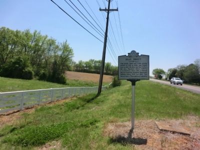
Photographed by Don Morfe, April 23, 2014
2. Billy Direct Marker
Credits. This page was last revised on January 20, 2020. It was originally submitted on July 4, 2014, by Don Morfe of Baltimore, Maryland. This page has been viewed 1,417 times since then and 83 times this year. Photos: 1, 2. submitted on July 4, 2014, by Don Morfe of Baltimore, Maryland. • Bill Pfingsten was the editor who published this page.
