
Downtown Silver Spring in Montgomery County, Maryland — The American Northeast (Mid-Atlantic)
Canada Dry Building
Photographed by Allen C. Browne, July 11, 2010
1. Canada Dry Building Marker
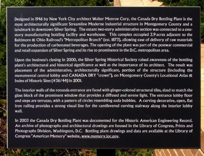
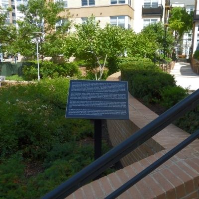
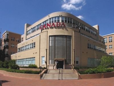
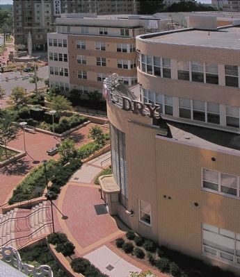
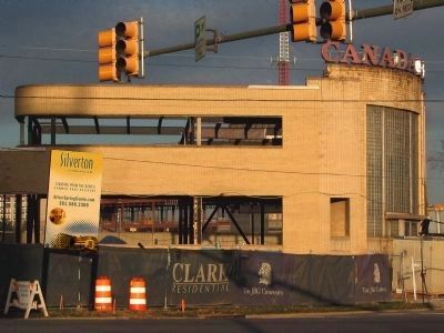
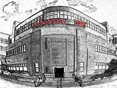
Designed in 1946 by New York City architect Walter Monroe Cory, the Canada Dry Bottling Plant is the most architecturally significant Streamline Moderne industrial structure in Montgomery County and a landmark in downtown Silver Spring. The extant two-story administrative section was connected to a one story manufacturing bottling facility and warehouse. This complex occupied 2.9-acres adjacent to the Baltimore & Ohio Railroad's "Metropolitan Branch" (est. 1873), allowing ease of delivery of raw materials for the production of carbonated beverages. The opening of the plant was part of the postwar commercial and retail expansion of Silver Spring and its rise to prominence in the D.C. metropolitan area.
Upon the business's closing in 2000, the Silver Spring Historical Society raised awareness of the bottling plant's architectural and historical significance as well as the importance of its architect. The result was placement of the administrative, architecturally significant, portion of the structure (including the monumental central lobby and CANADA DRY "crown"), on Montgomery County's Locational Atlas & Index of Historic
this page online
In 2003 the Canada Dry Bottling Plant was documented for the Historic American Engineering Record. An archive of photographs and architectural drawings are housed in the Library of Congress, Prints and Photographs Division, Washington, D.C. Bottling plant drawings and data are available at the Library of Congress "American Memory" website, www.memory.gov.
Topics and series. This historical marker is listed in these topic lists: Architecture • Industry & Commerce • Railroads & Streetcars. In addition, it is included in the Baltimore and Ohio Railroad (B&O) series list. A significant historical year for this entry is 1946.
Location. 38° 59.401′ N, 77° 1.703′ W. Marker is in
Photographed by Allen C. Browne, July 4, 2014
2. Canada Dry Building Marker

Regionally, this marker is in the Washington Metropolitan Area. It is also in the American Mid-Atlantic. Globally, it is in North America, the Western Hemisphere, the Western World, and the Anglosphere. Historically, it finds itself in what was once one of the original Thirteen Colonies and also the Antebellum South.
Other nearby markers. At least 8 other markers are within walking distance of this marker: The Community of Silver Spring (within shouting distance of this marker); Silver Spring Shopping Center (within shouting distance of this marker); The Silver Spring (within shouting distance of this marker); Silver Spring Armory 1914 (about 300 feet away, measured in a direct line); Silver Spring B & O Railroad Station (about 300 feet away); Early's Raid on Washington (about 300 feet
Photographed by Allen C. Browne, July 11, 2010
3. Canada Dry Building (Silverton)
Photographed by Allen C. Browne, July 11, 2010
4. Canada Dry Building (Silverton)
Photographed by Allen C. Browne, July 4, 2010
5. Canada Dry Building (Silverton)
Photographed by Allen C. Browne, November 17, 2004
6. Canada Dry Building
Photographed by Allen C. Browne, July 11, 2010
7. Canada Dry Building

Historic American Buildings Survey, 2003
8. Location Map in downtown Silver Spring
Credits. This page was last revised on December 15, 2025. It was originally submitted on July 4, 2014, by Allen C. Browne of Silver Spring, Maryland. This page has been viewed 3,763 times since then and 333 times this year. Photos: 1, 2, 3, 4, 5, 6, 7, 8. submitted on July 4, 2014, by Allen C. Browne of Silver Spring, Maryland. • Bill Pfingsten was the editor who published this page.
