Mt. Storm in Grant County, West Virginia — The American South (Appalachia)
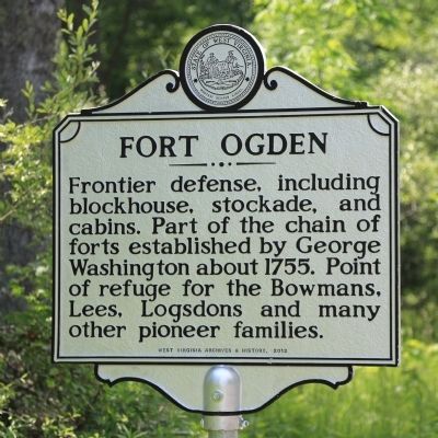
Fort Ogden
Erected 2012 by West Virginia Archives and History.
Topics and series. This historical marker is listed in this topic list: Forts and Castles. In addition, it is included in the West Virginia Archives and History series list. A significant historical year for this entry is 1755.
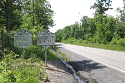
Location. 39° 16.705′ N, 79° 17.622′ W. Marker is in Mt. Storm, West Virginia, in Grant County. Marker is on George Washington Highway (U.S. 50) west of Cherry Ridge Road, on the left when traveling west. Touch for map. Marker is in this post office area: Mount Storm WV 26739, United States of America. Touch for directions.
Other nearby markers. At least 8 other markers are within 9 miles of this marker, measured as the crow flies. By King’s Command (here, next to this marker); Honor Roll (approx. 2.8 miles away); In Honor (approx. 2.9 miles away); Grant County / State of Maryland (approx. 3 miles away); Site of Civil War Fort Pendleton (approx. 3.4 miles away in Maryland); Mineral County / Grant County (approx. 6.3 miles away); Highest Point on the Maryland State Roads System (approx. 6.7 miles away in Maryland); St. John's Evangelical Lutheran Church of Red House, Maryland (approx. 8.8 miles away in Maryland). Touch for a list and map of all markers in Mt. Storm.
More about this marker. This marker is hard to see when traveling east.
Credits. This page was last revised on June 16, 2016. It was originally submitted on July 8, 2014, by J. J. Prats of Powell, Ohio. This page has been viewed 1,300 times since then and 81 times this year. Photos: 1, 2. submitted on July 8, 2014, by J. J. Prats of Powell, Ohio.

