Morristown in Morris County, New Jersey — The American Northeast (Mid-Atlantic)
Chain of Signal Beacons
Inscription.
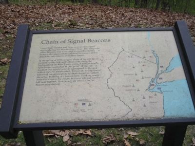
Large fires, cannon and flags were used to signal alarms during the Revolutionary War. The fires were called beacons and were used to assemble militia, indicate the approach direction of the enemy and to direct the movements of military forces.
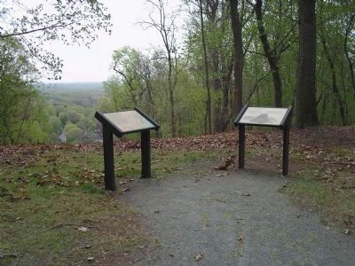
In the spring of 1779, a signal chain of log and brush pyramids was ordered built in a line along the highlands of the New Jersey coast. A beacon was to have been constructed at the “point” of this hill – a location that would seem to correspond to the area within the 1777 fortification. However, no conclusive historical documentation has been found to confirm the actual building of a beacon here. Looking south from this vista to the distant horizon, you can see the hill near Summit, New Jersey, on which another beacon was erected.
Erected by Morristown National Historical Park.
Topics. This historical marker is listed in these topic lists: Forts and Castles • War, US Revolutionary. A significant historical year for this entry is 1779.
Location. 40° 47.608′ N, 74° 29.301′ W. Marker is in Morristown, New Jersey, in Morris County. Marker is on Chestnut Street, on the left when traveling south. Marker is in Morristown National Historical Park, in the Fort Nonsense section, off Chestnut Street. Touch for map. Marker is in this post office area: Morristown NJ 07960, United States of America. Touch for directions.
Other nearby markers. At least 8 other markers are within walking distance of this marker. The Alarm Beacon (here, next to this marker); Fort Nonsense (within shouting distance of this marker); a different marker also named Fort Nonsense (within shouting distance of this marker); The Lay of the Land (within shouting distance of this marker); Morristown (within shouting distance of this marker); The Upper Redoubt (about 300 feet away, measured in a direct line); Iron (about 300 feet away); Mt. Kemble Home (approx. ¼ mile away). Touch for a list and map of all markers in Morristown.
More about this marker. The marker contains a map showing American and British troop positions, as well as the locations of signal beacons, in New Jersey and southern New York State.
Also see . . . Fort Nonsense. Morristown National Historical Park. (Submitted on May 1, 2008, by Bill Coughlin of Woodland Park, New Jersey.)
Credits. This page was last revised on June 16, 2016. It was originally submitted on May 1, 2008, by Bill Coughlin of Woodland Park, New Jersey. This page has been viewed 2,158 times since then and 93 times this year. Photos: 1, 2, 3. submitted on May 1, 2008, by Bill Coughlin of Woodland Park, New Jersey. • Kevin W. was the editor who published this page.


