Tampa in Hillsborough County, Florida — The American South (South Atlantic)
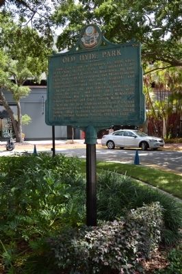
Old Hyde Park
In the 1840's the first American pioneers to "cross the river" and settle the area were W.T. Haskin, Wm. A. Morrison, James M. Watrous, Robert Jackson and Capt. Joseph Moore.
Actually the first settlement in Hyde Park was Spanishtown Creek which consisted of a small fishing village, a cluster of palmetto huts, dating to the Second Spanish Period, 1783 to 1821.
Erected 1985 by Tampa Historical Society.
Topics. This historical marker is listed in these topic lists: Notable Places • Settlements & Settlers. A significant historical month for this entry is February 1891.
Location. 27° 56.184′ N, 82° 28.528′ W. Marker is in Tampa, Florida, in Hillsborough County. Marker is on South Village Circle east of South Dakota Avenue, on the right when traveling south. Touch for map. Marker is in this post office area: Tampa FL 33606, United States of America. Touch for directions.
Other nearby markers. At least 8 other markers are within walking distance of this marker. Alfred Reuben Swann (about 400 feet away, measured in a direct line); Hyde Park's Bungalow Terrace (about 600 feet away); Kate Jackson Recreation Center (about 800 feet away); Woodrow Wilson Junior High School (approx. 0.3 miles away); William Gordon Burnett (approx. 0.3 miles away); Dobyville (approx. 0.4 miles away); The Rough Riders Procure a Coal Train (approx. 0.6 miles away); Spanishtown Creek (approx. 0.7 miles away). Touch for a list and map of all markers in Tampa.
Credits. This page was last revised on June 16, 2016. It was originally submitted on July 10, 2014, by Paige Carbon of Tampa, Florida. This page has been viewed 591 times since then and 25 times this year. Last updated on July 10, 2014. Photo 1. submitted on July 10, 2014, by Paige Carbon of Tampa, Florida. • Bernard Fisher was the editor who published this page.
