Oswego in Oswego County, New York — The American Northeast (Mid-Atlantic)
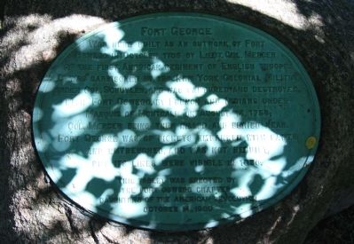
Fort George
Was here built as an outwork of Fort
Oswego in October 1755 by Lieutenant Colonel Mercer
of the first American regiment of English troops.
It was garrisoned by 150 New York Colonial Militia
under Colonel Schuyler, and was captured and destroyed,
with Fort Oswego, by French and Indians under
Marquis of Montcalm on August 14, 1756;
Colonel Mercer being then killed and buried near.
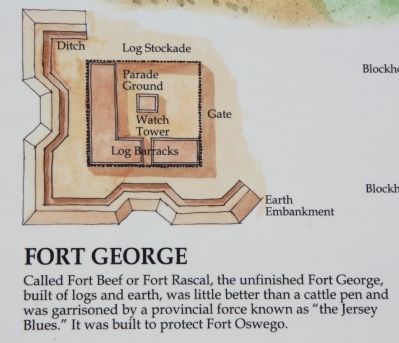
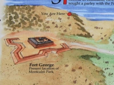
Fort George was of pickets embanked with earth
and entrenched, and was not rebuilt,
but its lines were visible in 1850.
Erected 1909 by the Fort Oswego Chapter Daughters of the American Revolution.
Topics and series. This historical marker is listed in these topic lists: Forts and Castles • War, French and Indian. In addition, it is included in the Daughters of the American Revolution series list. A significant historical month for this entry is October 1755.
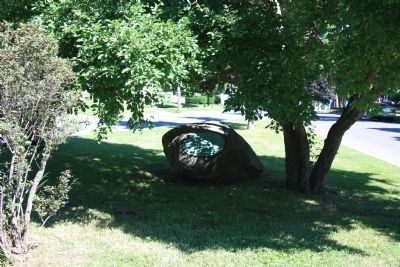
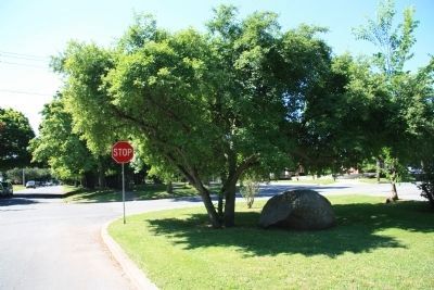
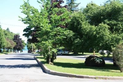
Location. 43° 27.604′ N, 76° 31.171′ W. Marker is in Oswego, New York, in Oswego County. Marker is at the intersection of Montcalm Street and West 6th Street, on the left when traveling south on Montcalm Street. This historical marker is affixed to a large boulder, and located on a traffic island, in a "Y" intersection. Touch for map. Marker is in this post office area: Oswego NY 13126, United States of America. Touch for directions.
Other nearby markers. At least 8 other markers are within walking distance of this marker. Open Water = Winter Birds (about 800 feet away, measured in a direct line); Wreck of the David W. Mills (approx. 0.2 miles away); Oswego West Side Forts (approx. 0.2 miles away); Oswego Harbor West Pierhead Lighthouse (approx. 0.2 miles away); Fort Oswego (approx. 0.3 miles away); a different marker also named Fort Oswego (approx. 0.3 miles away); Oswego Harbor (approx. 0.3 miles away); LT-5 TUG (approx. 0.3 miles away). Touch for a list and map of all markers in Oswego.
More about this marker. Just two blocks to the north, where Montcalm Street ends at Lake Street, there is a roadside park with a Seaway Trails marker on the French and Indian War era that provides significant additional details and insights into the history of Fort George and Fort Oswego.
Also see . . .
1. Fort George (6) - FortWiki Historic U.S. and Canadian Forts. This is a link to information provided by FortWiki. (Submitted on July 15, 2014, by Dale K. Benington of Toledo, Ohio.)
2. Battle of Fort Oswego (1756) - Wikipedia, the free ... This is a link to information provided by Wikipedia, the free encyclopedia. (Submitted on July 15, 2014, by Dale K. Benington of Toledo, Ohio.)
Credits. This page was last revised on June 16, 2016. It was originally submitted on July 15, 2014, by Dale K. Benington of Toledo, Ohio. This page has been viewed 621 times since then and 44 times this year. Photos: 1, 2, 3, 4, 5, 6. submitted on July 15, 2014, by Dale K. Benington of Toledo, Ohio.
