Asheville in Buncombe County, North Carolina — The American South (South Atlantic)
Smith-McDowell House
Our Businessman-Soldier
Photographed by Don Morfe, April 27, 2014
1. Smith-McDowell House Marker
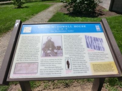
Soon afterward, McDowell fell ill and on July 2 was furloughed home. In the summer 1862, he raised a company (the Buncombe Farmers) that was incorporated into the 60th North Carolina Infantry under McDowell’s brother, Col. Joseph A. McDowell. William McDowell served in the regiment first as a captain and then as major until after the Battle of Stone’s River in January 1863. Back home by 1864, McDowell became a Confederate treasury officer
this page online
One of McDowell’s slaves, George Avery, a 19-year-old blacksmith, enlisted with McDowell’s encouragement in the 40th United States Colored Troops in April 1865. The unit guarded railroads in East Tennessee and mustered out in February 1866. Avery returned to Buncombe County and became superintendent of the South Asheville Colored Cemetery, which was first used as McDowell slave cemetery.
(sidebar)
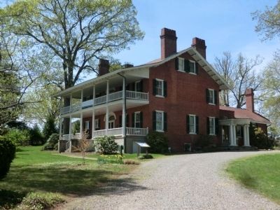
James McConnell Smith, an early entrepreneur and one of the wealthiest and most influential men in antebellum Asheville, constructed this Federal and Greek Revival-style dwelling about 1840. His daughter, Sarah Lucinda Smith, married William Wallace McDowell and acquired the house. It remained in the McDowell family until 1883.
(captions)
(lower left) Receipt bearing McDowell’ signature, June 23, 1864
(upper center) Capt. Wm. W. McDowell, Buncombe Riflemen, ca. 1859
(lower center) George Avery, Feb. 18, 1917, age 71
(upper right) 1st North Carolina Infantry battle flag
Erected by North Carolina Civil
Photographed by Don Morfe, April 27, 2014
2. Smith-McDowell House
Topics and series. This historical marker is listed in these topic lists: African Americans • Industry & Commerce • War, US Civil. In addition, it is included in the North Carolina Civil War Trails series list. A significant historical month for this entry is January 1863.
Location. 35° 34.327′ N, 82° 33.302′ W. Marker is in Asheville, North Carolina, in Buncombe County. It can be reached from Victoria Road 0.1 miles south of Oakland Road, on the right when traveling south. Touch for map. Marker is at or near this postal address: 283 Victoria Road, Asheville NC 28801, United States of America. Touch for directions.

Regionally, this marker is in the Mountains. It is also in the American South, specifically in the Upper South, in Appalachia, and specifically in Southern Appalachia. Globally, it is in North America, the Western Hemisphere, the Western World, and the Anglosphere. Historically, it finds itself in what was once the original Cherokee Nation, the territory of the Mississippian Culture, one of the original Thirteen Colonies, one of the Confederate States of America, and the Antebellum South.
Other nearby markers. At
Photographed by Don Morfe, April 27, 2014
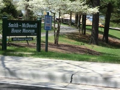
3. Smith-McDowell House Museum-sign at the entrance
Related marker. Click here for another marker that is related to this marker.
Also see . . . Smith-McDowell House Museum. (Submitted on July 21, 2014.)
Credits. This page was last revised on June 16, 2016. It was originally submitted on July 20, 2014, by Don Morfe of Baltimore, Maryland. This page has been viewed 1,171 times since then and 38 times this year. Photos: 1, 2, 3. submitted on July 20, 2014, by Don Morfe of Baltimore, Maryland. • Bernard Fisher was the editor who published this page.
