Manchester in Carroll County, Maryland — The American Northeast (Mid-Atlantic)
Manchester
Meade's Pipe Creek Plan
— Gettysburg Campaign —
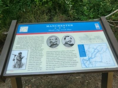
On June 29, 1863, Union Gen. George G. Meade ordered the Army of the Potomac to Pipe Creek to counter any move toward Washington or Baltimore by Gen. Robert E. Lee’s Army of Northern Virginia and to engage the Confederates in battle. Meade was uncertain of Lee’s strength or location.
The Federal right flank rested here at Manchester, the center at Union Mills and the left at Middleburg. Gen. John Sedgwick’s VI Corps, Meade’s largest, occupied the position with 15,000 men on June 30, after marching from New Windsor through Westminster. Soon the landscape here was dotted for miles with tents and campfires. Manchester’s kind citizens brought bread, cakes, pies, and milk to the exhausted and footsore soldiers, some of whom lacked shoes. The next day the men rested, cleaned their weapons, and drew sixty rounds of ammunition each. Late in the evening, the order came to march again. VI Corps retraced its steps in the direction of Westminster to intersect Littlestown Turnpike and then marched north. The 34-mile march from Manchester in darkness and then under a scorching sun to Gettysburg was one of the longest and fastest marches of the Civil War.
Erected by Maryland Civil War Trails.
Topics and series. This historical marker is listed in this topic list: War, US Civil . In addition, it is included in the Maryland Civil War Trails series list. A significant historical date for this entry is June 29, 1863.
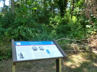
Location. Marker has been reported missing. It was located near 39° 39.734′ N, 76° 53.463′ W. Marker was in Manchester, Maryland, in Carroll County. Marker was on Manchester Road (Maryland Route 27) 0.3 miles west of Main Street (Maryland Route 30), on the right when traveling west. The marker was located in Westside Memorial Park. Touch for map. Marker was at or near this postal address: 2900 Manchester Rd, Manchester MD 21102, United States of America. Touch for directions.
Other nearby markers. At least 8 other markers are within walking distance of this location. A different marker also named Manchester (approx. 0.3 miles away); German Church (approx. 0.4 miles away); September 11 Memorial (approx. 0.4 miles away); a different marker also named Manchester (approx. 0.4 miles away); Manchester District (approx. 0.4 miles away); Town of Manchester (approx. 0.4 miles away); June 30 1863 (approx. 0.4 miles away); Army of the Potomac (approx. 0.4 miles away). Touch for a list and map of all markers in Manchester.
Additional commentary.
1. Missing
This marker appears to have been removed or relocated.
—  Submitted July 10, 2023, by Ronald Cupo of Lansdale, Pennsylvania.

Photographed By Don Morfe, July 26, 2014
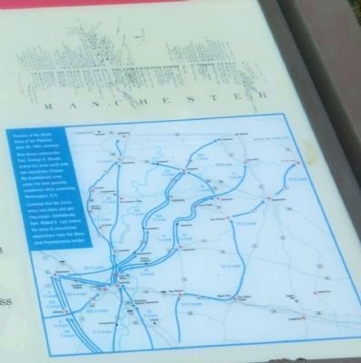
2. Close up of map shown on the marker
Position of the Union Army of the Potomac June 23, 1863 (midday), New Union commander Gen. George G Meade orders his army north with two objectives. Engage the Confederate Army under the best possible conditions while protecting Washington, D.C.
Learning that the Union army was close and getting closer, Confederate Gen. Robert E. Lee orders his army to consolidate somewhere near the Maryland-Pennsylvania border.
Learning that the Union army was close and getting closer, Confederate Gen. Robert E. Lee orders his army to consolidate somewhere near the Maryland-Pennsylvania border.
Credits. This page was last revised on July 10, 2023. It was originally submitted on July 27, 2014, by Don Morfe of Baltimore, Maryland. This page has been viewed 824 times since then and 39 times this year. Last updated on July 7, 2022, by Carl Gordon Moore Jr. of North East, Maryland. Photos: 1, 2, 3, 4. submitted on July 27, 2014, by Don Morfe of Baltimore, Maryland. • Bernard Fisher was the editor who published this page.


