Willmar in Kandiyohi County, Minnesota — The American Midwest (Upper Plains)
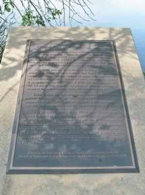
Geology of the Willmar Region
The agricultural land of the Willmar region has a history that dates back 60 million years, when an inland sea covered the Great Plains from the Gulf of Mexico to the Arctic Ocean. As the adjacent land eroded and life in the sea flourished, sediments for sandstone, shale, and limestone were deposited on the sea floor and eventually became rock. Later, when the sea level dropped, these sedimentary rocks were exposed on dry land.
About 14,000 years ago, during the end of the Ice Age of the last two million years, glaciers advancing southward from Canada scraped up and carried great quantities of those sedimentary marine rocks from Manitoba and northwestern Minnesota. When the ice melted, rock fragments, crushed by the moving ice, were left as a layer of glacial drift across the state. This drift was rich in lime, magnesia and potash, so became a great natural resource as the parent material for fertile soils over much of the state.
Earlier glaciers also advanced across Minnesota from the north-northeast about 25,000 years ago. This ice eroded the igneous bedrock in Ontario and the Lake Superior region and deposited a reddish, more sandy and rocky drift. Soils that developed from this parent material are not as fertile.
Most of the surface material in the Willmar region is the rich, fertile sediment deposited by the more recent glaciers from the northwest. The belt of hilly topography and abundant lakes northwest of Willmar, however, once marked the edge of a glacial lobe from the north-northeast. The margin of that ice left piles of sediment there at its farthest advance, forming a glacial deposit called a terminal moraine. While this moraine is buried under the more recent drift from the northwest, its effect on the topography is still very evident.
Minnesota Department of Transportation and the Minnesota Geological Survey 1998
Erected 1998 by the Geological Society of Minnesota in partnership with the Minnesota Department of Transportation and the Minnesota Geological Survey.
Topics and series. This historical marker is listed in this topic list: Natural Features. In addition, it is included in the Minnesota: Geological Society of Minnesota series list. A significant historical year for this entry is 1998.
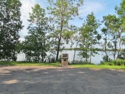
Location. 45° 7.626′ N, 95° 2.782′ W. Marker is in Willmar, Minnesota, in Kandiyohi County. Marker can be reached from Ella Avenue Northwest, 0.1 miles west of Business U.S. 71, on the right when traveling west. Marker is along the south shore of Foot Lake in Thompson

Photographed By K. Linzmeier, July 16, 2014
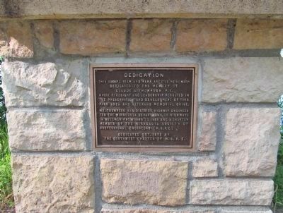
2. Dedication Plaque on Pedestal
Dedication • This scenic view and park area is herewith dedicated to the memory of Claude A. Thompson P.E. whose foresight and leadership resulted in the preservation and development of this park area and Veterans Memorial Drive. Mr. Thompson was District Highway Engineer for the Minnesota Department of Highways in Willmar from 1945 to 1965 and a charter member of the Minnesota Society of Professional Engineers (M.S.P.E.) • Dedicated Oct. 1972 by The Southwest Chapter of M.S.P.E.
Other nearby markers. At least 8 other markers are within walking distance of this marker. Veterans War Memorial (approx. 0.3 miles away); Sperry House (approx. 0.4 miles away); Berger Thorson Killed (approx. 0.4 miles away); The History of Kaffe Fest (approx. half a mile away); District #18 Schoolhouse (approx. half a mile away); Judge Qvale Cabin (approx. half a mile away); Engine 2523 (approx. half a mile away); "Kandiyohi" (approx. half a mile away). Touch for a list and map of all markers in Willmar.
Also see . . . Geology of Minnesota. Wikipedia entry. (Submitted on August 2, 2014.)
Additional keywords. Geology of Minnesota Willmar Region
Credits. This page was last revised on June 16, 2016. It was originally submitted on August 2, 2014, by Keith L of Wisconsin Rapids, Wisconsin. This page has been viewed 554 times since then and 22 times this year. Photos: 1, 2, 3. submitted on August 2, 2014, by Keith L of Wisconsin Rapids, Wisconsin.

