Batavia in Genesee County, New York — The American Northeast (Mid-Atlantic)
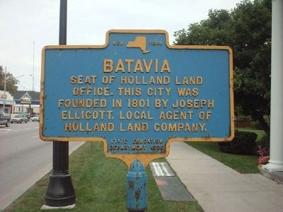
Batavia
Photographed by Patrick Weissend, September 22, 2006
1. Batavia Marker
Erected 1936 by State Education Department.
Topics and series. This historical marker is listed in this topic list: Settlements & Settlers. In addition, it is included in the National Historic Landmarks series list. A significant historical year for this entry is 1801.
Location. 42° 59.96′ N, 78° 11.435′ W. Marker is in Batavia, New York, in Genesee County. It is on West Main Street (New York State Route 5/63/33) 0.2 miles east of Oak Street ( Route 98), on the right when traveling east. Touch for map. Marker is at or near this postal address: 131 West Main Street, Batavia NY 14020, United States of America. Touch for directions.

Regionally, this marker is in Upstate New York, specifically in Western New York, in the Finger Lakes, and in the Rochester Metropolitan Area. It is also in the American Northeast and in the Mid-Atlantic. Globally, it is in North America, the Western Hemisphere, the Western World, and the Anglosphere. Historically, it finds itself in what was once the Haudenosaunee
this page online
Other nearby markers. At least 8 other markers are within walking distance of this marker: Gabriel DeFabbio (a few steps from this marker); Capt. Charles F. Rand (a few steps from this marker); War of 1812 (within shouting distance of this marker); Paolo Busti Monument (within shouting distance of this marker); Batavia Peace Garden (within shouting distance of this marker); Batavia Peace Garden Artwork & Monuments (within shouting distance of this marker); The Grove of Nations / The Millstone (about 300 feet away, measured in a direct line); a different marker also named Batavia Peace Garden (about 400 feet away). Touch for a list and map of all markers in Batavia.
Also see . . .
1. Holland Land Office Museum. (Submitted on July 21, 2014, by Anton Schwarzmueller of Wilson, New York.)
2. Holland Land Office - Wikipedia. (Submitted on July 21, 2014, by Anton Schwarzmueller of Wilson, New York.)
3. Joseph Ellicott - Wikipedia. (Submitted on July 21, 2014, by Anton Schwarzmueller of Wilson, New York.)
4. Holland Land Company - Wikpedia.
Photographed by Anton Schwarzmueller, July 6, 2014
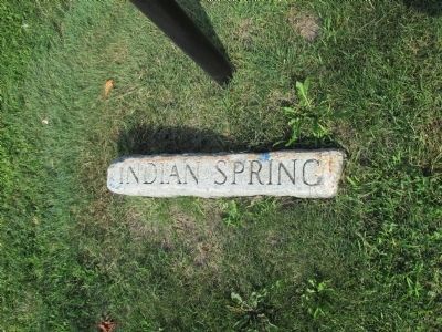
2. Stone at Base of Batavia Marker
This stone is at the base of the marker.
Photographed by Anton Schwarzmueller, July 6, 2014
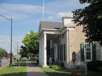
3. Eastward View Batavia Marker (left) and Capt. Charles F. Rand Marker (right)
Photographed by Anton Schwarzmueller, July 6, 2014
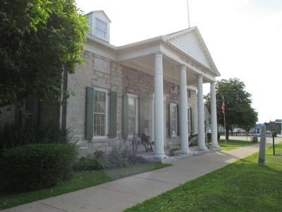
4. Westward View Batavia Marker and Holland Land Office Museum
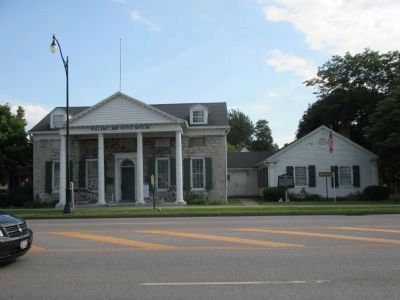
Photographed by Anton Schwarzmueller, July 6, 2014
5. Direct View Batavia Marker and Capt. Charles F. Rand Marker
Notice the plaques above the door and three windows of the Holland Land Office Museum.
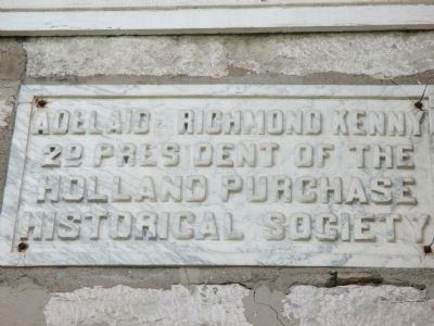
Photographed by Anton Schwarzmueller, July 6, 2014
6. Plaque Over the Left-most Window
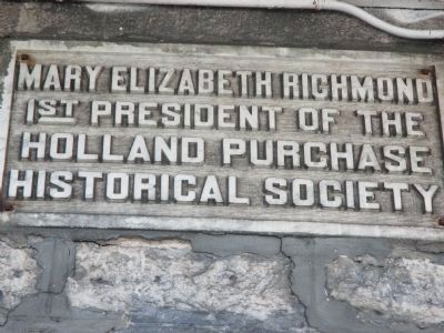
Photographed by Anton Schwarzmueller, July 6, 2014
7. Plaque Over the Window Left of the Door
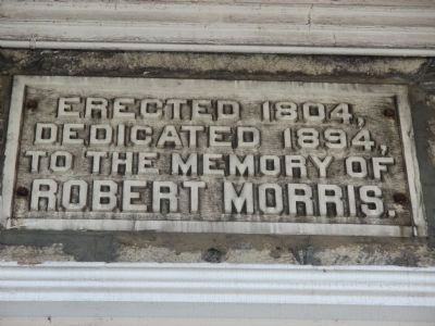
Photographed by Anton Schwarzmueller, July 6, 2014
8. Plaque Over Door
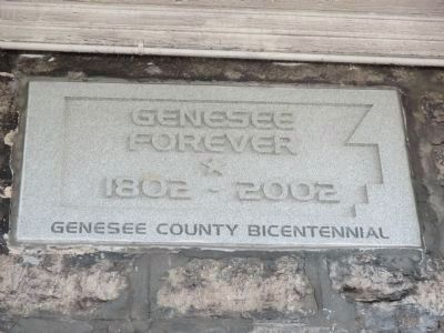
Photographed by Anton Schwarzmueller, July 6, 2014
9. Plaque Over Window Right of Door
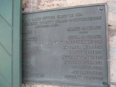
Photographed by Anton Schwarzmueller, July 6, 2014
10. Plaque Left of Door
Partially covered by window shutter.
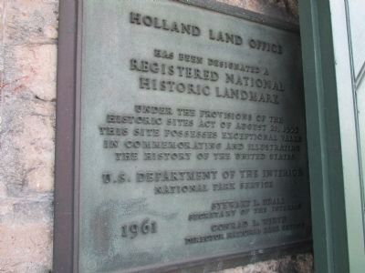
Photographed by Anton Schwarzmueller, July 6, 2014
11. Registered National Historic Landmark Plaque
Right of door, partially covered by window shutter.
Photographed by Anton Schwarzmueller, July 6, 2014
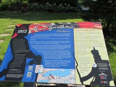
12. War of 1812 Peace Garden Plaque
To the left of the porch of the museum.
Credits. This page was last revised on June 16, 2016. It was originally submitted on January 9, 2011, by Patrick Weissend of Corfu, New Yok. This page has been viewed 1,157 times since then and 50 times this year. Last updated on August 2, 2014, by Anton Schwarzmueller of Wilson, New York. Photos: 1. submitted on January 9, 2011, by Patrick Weissend of Corfu, New Yok. 2, 3, 4, 5, 6, 7, 8, 9, 10, 11, 12. submitted on July 21, 2014, by Anton Schwarzmueller of Wilson, New York. • Bill Pfingsten was the editor who published this page.
