Sackets Harbor in Jefferson County, New York — The American Northeast (Mid-Atlantic)
British Attack on Sackets Harbor
May 29, 1813
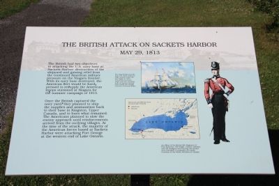
Once the British captured the navy yard, they planned to ship the supplies and ammunition back to their base in Kingston, Upper Canada, and to burn what remained. The Americans planned to slow the enemy approach until reinforcements arrived from the outlying villages. At the time of the attack, the majority of the American forces based at Sackets Harbor were attacking Fort George at the western end of Lake Ontario.
Erected by the State of New York. (Marker Number 2.)
Topics. This historical marker is listed in this topic list: War of 1812. A significant historical year for this entry is 1813.
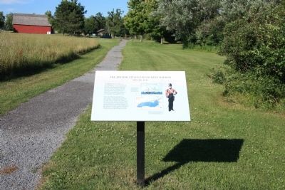
Location. 43° 56.822′ N, 76° 7.719′ W. Marker is in Sackets Harbor, New York, in Jefferson County. Marker can be reached from Washington Street west of Ontario Street. This historical marker is located in Sackets Harbor Battlefield State Park, along the walking path that leads from the battlefield to near the site of Fort Kentucky where the British assault on the defenses of Sackets Harbor began. Touch for map. Marker is in this post office area: Sackets Harbor NY 13685, United States of America. Touch for directions.
Other nearby markers. At least 8 other markers are within walking distance of this marker. Smoothbore Muzzle Loader Cannon (within shouting distance of this marker); The British Observation Point (within shouting distance of this marker); The British Advance is Halted (about 300 feet away, measured in a direct line); The Landing Area (about 400 feet away); Fort Kentucky (about 400 feet away); American Dragoon Commander Wounded (approx. 0.2 miles away); a different marker also named Smoothbore Muzzle Loader Cannon (approx. 0.2 miles away); Welcome to Sackets Harbor Battlefield (approx. 0.2 miles away). Touch for a list and map of all markers in Sackets Harbor.
Also see . . . Sackets harbor Battlefield - National Archives. National Register of Historic Places documentation (Submitted on February 25, 2024, by Anton Schwarzmueller of Wilson, New York.)
Credits. This page was last revised on February 25, 2024. It was originally submitted on August 2, 2014, by Dale K. Benington of Toledo, Ohio. This page has been viewed 442 times since then and 20 times this year. Photos: 1, 2, 3. submitted on August 10, 2014, by Dale K. Benington of Toledo, Ohio.


