Fort Montgomery in Orange County, New York — The American Northeast (Mid-Atlantic)
Round Hill Redoubt
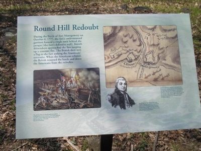
During the Battle of Fort Montgomery on October 6, 1777, the fort’s undermanned garrison formed a single rank behind the parapet (the fort’s defensive wall). British skirmishers approached the fort keeping up a constant fire. The British then sent a flag to the fort seeking the Americans’ surrender. When the Americans refused, the British resumed the battle and drove the Americans from the redoubts.
Erected by Montgomery State Historic Site.
Topics. This historical marker is listed in these topic lists: Forts and Castles • War, US Revolutionary. A significant historical month for this entry is October 1621.
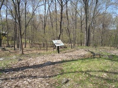
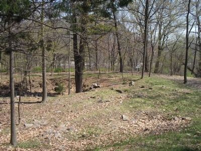
Location. 41° 19.567′ N, 73° 59.387′ W. Marker is in Fort Montgomery, New York, in Orange County. Marker is in Fort Montgomery State Historic Site, west of Route 9W. Touch for map. Marker is in this post office area: Fort Montgomery NY 10922, United States of America. Touch for directions.
Other nearby markers. At least 8 other markers are within walking distance of this marker. A different marker also named Round Hill Redoubt (a few steps from this marker); Welcome to Fort Montgomery (about 300 feet away, measured in a direct line); West Redoubt (about 500 feet away); Fort Montgomery (about 500 feet away); North Redoubt (about 600 feet away); The Battle Around the Redoubts (about 600 feet away); Enlisted Men’s & Officers’ Barracks (about 600 feet away); Barracks (about 700 feet away). Touch for a list and map of all markers in Fort Montgomery.
More about this marker. The bottom left of the marker contains an illustration by Jack Mead, with the caption “This painting depicts the British assault on a redoubt. As the British carried the redoubts, many of the Americans were able to escape under the cover of growing darkness and the smoky haze of the battle.”
The upper right of the marker features a map with the caption “Several Loyalist units took part in the attack on Fort Montgomery, including the Loyal American Regiment, the Regiment of New York Volunteers, and Emmerich's Chasseurs. The discovery of odd-size musket balls on the outer face of this redoubt suggests that they attacked this redoubt as well as the so-called “North” redoubt. Reproduced by permission of the Huntington Library, San Marino, California..
The bottom of the marker features a picture of “Beverly Robinson, the Colonel of the Loyal American Regiment, assumed command of the attack on Fort Montgomery when Lieutenant-Colonel Mungo Campbell was shot and killed. Engraving on Beverly
Robinson from Benson Lossing’s Pictorial Fieldbook of the Revolution.”
Related markers. Click here for a list of markers that are related to this marker. This series of markers follow the walking tour of the Fort Montgomery Battlefield.
Also see . . .
1. The Battle of Fort's (sic) Montgomery and Clinton. The American Revolutionary War website entry (Submitted on May 4, 2008, by Bill Coughlin of Woodland Park, New Jersey.)
2. Fort Montgomery State Historic Site. New York State Parks, Recreation and Historic Preservation website entry (Submitted on August 18, 2021, by Larry Gertner of New York, New York.)
Credits. This page was last revised on August 18, 2021. It was originally submitted on May 4, 2008, by Bill Coughlin of Woodland Park, New Jersey. This page has been viewed 1,200 times since then and 21 times this year. Photos: 1, 2, 3. submitted on May 4, 2008, by Bill Coughlin of Woodland Park, New Jersey. • Kevin W. was the editor who published this page.


