Batsto in Hammonton in Burlington County, New Jersey — The American Northeast (Mid-Atlantic)
Auxiliary Power System
Photographed by Bill Coughlin, August 8, 2014
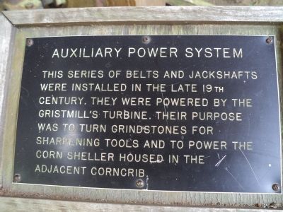
1. Auxiliary Power System Marker
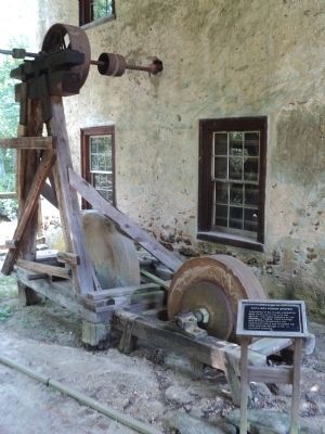
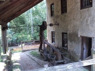
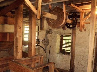
This series of belts and jackshafts were installed in the late 19th century. They were powered by the gristmill’s turbine, Their purpose was to turn grindstones for sharpening tools and to power the corn sheller housed in the adjacent corncrib.
Topics. This historical marker is listed in this topic list: Industry & Commerce.
Location. 39° 38.568′ N, 74° 38.943′ W. Marker is in Hammonton, New Jersey, in Burlington County. It is in Batsto. It can be reached from Batsto Road, on the right when traveling north. Marker is located in Historic Batsto Village, near the gristmill. Touch for map. Marker is at or near this postal address: 31 Batsto Rd, Egg Harbor City NJ 08215, United States of America. Touch for directions.

Regionally, this marker is in New Jersey’s South Jersey, in the Pine Barrens, and in Greater Philadelphia. It is also in the American Northeast, in the Mid-Atlantic, and on the Eastern Seaboard. Globally, it is in the North Atlantic Region, North America, the Western Hemisphere, the Western World, and the Anglosphere. Historically, it finds
this page online
Other nearby markers. At least 8 other markers are within walking distance of this marker: Swimming the Ladder to Success (about 500 feet away, measured in a direct line); Wagon (about 500 feet away); Bog Ore (about 600 feet away); Ore Boat or Barge (about 600 feet away); A Pane in the Glass Factory (about 800 feet away); Exploring the Pinelands (approx. 0.2 miles away); Wharton State Forest (approx. 0.2 miles away); William K. Phillis War Memorial (approx. 0.7 miles away). Touch for a list and map of all markers in Hammonton.
Also see . . . Batsto - A Journey into the Past. Historic Batsto Village website. (Submitted on August 11, 2014, by Bill Coughlin of Woodland Park, New Jersey.)
Photographed by Bill Coughlin, August 8, 2014
2. Auxiliary Power System Marker
Photographed by Bill Coughlin, August 8, 2014
3. Marker in Historic Batsto Village
Photographed by Bill Coughlin, August 8, 2014
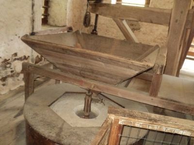
4. Grindstone Inside the Gristmill
Photographed by Bill Coughlin, August 8, 2014
5. Inside the Gristmill
The belts and jackshafts mentioned on the marker can be seen here.
Photographed by Bill Coughlin, August 8, 2014
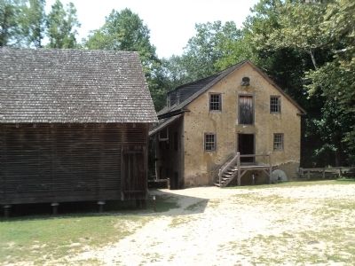
6. Corncrib and Gristmill at Batsto Village
Photographed by Bill Coughlin, August 8, 2014
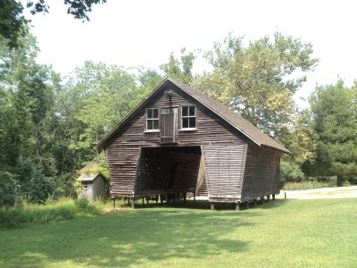
7. Corncrib
Credits. This page was last revised on July 30, 2026. It was originally submitted on August 11, 2014, by Bill Coughlin of Woodland Park, New Jersey. This page has been viewed 599 times since then and 31 times this year. Last updated on July 30, 2026, by Donald B. Caselli (Barry) of Hopewell, Virginia. Photos: 1, 2, 3, 4, 5, 6, 7. submitted on August 11, 2014, by Bill Coughlin of Woodland Park, New Jersey. • Devry Becker Jones was the editor who published this page.
