Victoria in Capital, British Columbia — Canada’s West Coast (North America)
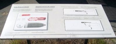
Gun Emplacement / Emplacement du canon
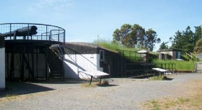
One 6-inch gun on a disappearing carriage was mounted in this emplacement. The wall and sunken emplacement helped to conceal and protect the gun and crew from enemy bombardment. The concrete apron and earth glacis extending away from the top of the wall was designed to deflect incoming shells.
Cet emplacement comprenait un canon de 6 pouces monté sur un affût à éclipse. Le mur et la fosse aidaient à dissimuler le canon et servaients à les protéger contre les bombardements ennemis. Le parapet du béton et le glacis de terre qui partait du sommet du mur servaient à faire dévier les obus ennemis.
[Left illustration caption]
Ammunition
Calibre = 6-inch
Weight = 100 pounds
Range = 10,000 yards
Munitions
Calibre = 6 pouces
Poids = 100 livres
Portée = 10 000 verges
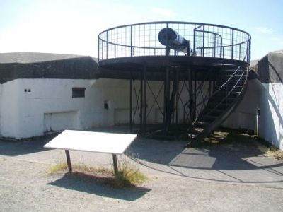
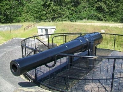
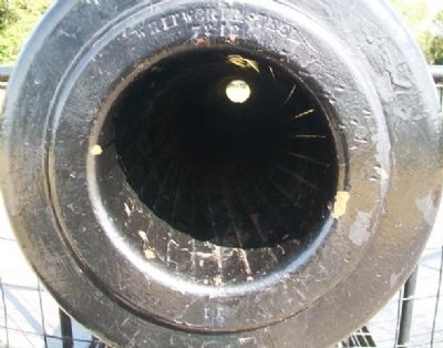
This is the original gun barrel that was mounted in this emplacement from 1897 to about 1943. The structure supporting it is not an original carriage.
Il s’agit du canon original installé à cet emplacement en 1897 et démonté vers 1943. Le bâti sur lequels il est monté n’est pas l’affût original.
[Top right illustration caption]
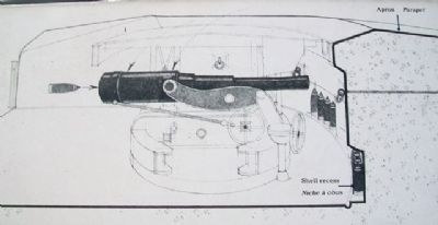
The disappearing carriage allowed the gun to be lowered behind the emplacement wall for reloading.
L’affût à éclipses permettait de baisser le canon derrière le mur de l’emplacement pour le recharger.
[Bottom right illustration caption]
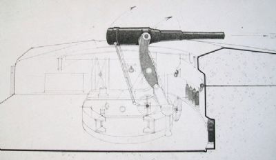
The gun was raised above the wall for firing.
Le canon était ensuite remonté au-dessus du mur pour le tir.
Erected by Parks Canada.
Topics. This historical marker is listed in these topic lists: Forts and Castles • War, World I • War, World II. A significant historical year for this entry is 1897.
Location. 48° 25.949′ N, 123° 27.249′ W. Marker is in Victoria, British Columbia, in Capital. Marker is at the Upper Battery at Fort Rodd Hill and Fisgard Lighthouse National Historic Sites of Canada. Touch for map. Marker is at or near this postal address: 603 Fort Rodd Hill Road, Victoria BC V9C 2W8, Canada. Touch for directions.
Other nearby markers. At least 8 other markers are within walking distance of this marker. The Victoria and Esquimalt Coast Defences (within shouting distance of this marker); Defence Electric Light Directing Station (within shouting distance of this marker); The Guardhouse / Corps de garde (within shouting distance of this marker); Defensible Wall / Mur défensif (within shouting distance of this marker); Upper Battery / Batterie supérieure (within shouting distance of this marker); Fisgard Lighthouse National Historic Site (about 90
meters away, measured in a direct line); Upper, Lower, Belmont Batteries (about 90 meters away); Heavy Metal and Drugs-in 1912? / La machinerie lourde en 1912... (about 90 meters away). Touch for a list and map of all markers in Victoria.
Also see . . .
1. Fort Rodd Hill and Fisgard Lighthouse National Historic Sites of Canada. Parks Canada website entry (Submitted on August 17, 2014, by William Fischer, Jr. of Scranton, Pennsylvania.)
2. Fort Rodd Hill - An Iconic Canadian Landmark. Landmark homepage (Submitted on August 17, 2014, by William Fischer, Jr. of Scranton, Pennsylvania.)
3. Defending the Coast. CFB Esquimalt Naval Military Museum entry (Submitted on August 17, 2014, by William Fischer, Jr. of Scranton, Pennsylvania.)
Credits. This page was last revised on January 7, 2022. It was originally submitted on August 17, 2014, by William Fischer, Jr. of Scranton, Pennsylvania. This page has been viewed 767 times since then and 10 times this year. Photos: 1, 2, 3, 4, 5, 6, 7. submitted on August 17, 2014, by William Fischer, Jr. of Scranton, Pennsylvania.
