
Huntertown in Allen County, Indiana — The American Midwest (Great Lakes)
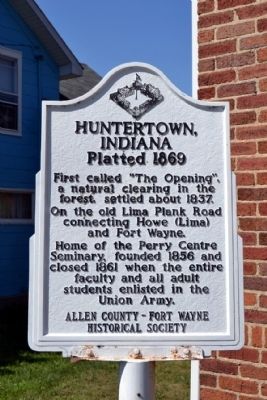
Huntertown, Indiana
Platted 1869
Photographed by Duane Hall, August 13, 2014
1. Huntertown, Indiana Marker
Erected by Allen County - Fort Wayne Historical Society.
Topics. This historical marker is listed in this topic list: Settlements & Settlers. A significant historical year for this entry is 1837.
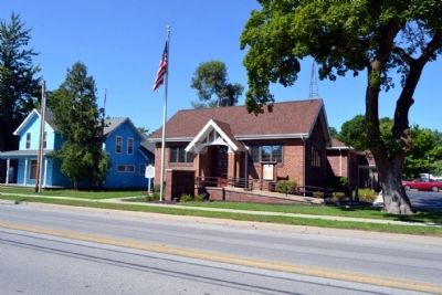
Location. 41° 13.708′ N, 85° 10.339′ W. Marker is in Huntertown, Indiana, in Allen County. It is on Lima Road north of Hunter Street, on the right when traveling south. Marker is located in front of the Huntertown Town Hall. Touch for map. Marker is at or near this postal address: 15617 Lima Rd, Huntertown IN 46748, United States of America. Touch for directions.

Regionally, this marker is in Northern Indiana and in Greater Fort Wayne. It is also in the American Midwest and in the Corn Belt. Globally, it is in North America, the Western Hemisphere, the Western World, and the Anglosphere. Historically, it finds itself in what was once the Viceroyalty of New France, the territory of the Mississippian Culture, and the Northwest Territory.
Other nearby markers. At least 8 other markers are within 8 miles of this marker, measured as the crow flies: This Tribute To… (approx. 6.7 miles away); Imagine the Untold Stories (approx. 6.9 miles away); Churubusco War Memorial (approx. 7.6 miles away); Johnny Krieger 1935-2003 (approx. 7.6 miles away); Little Turtle (approx. 7.7 miles away); Here's how Churubusco got its name (approx. 7.7 miles away); Churubusco Railroad Depot (approx. 7.7 miles away); DX Gas Station (approx. 7.7 miles away).
Other markers no longer nearby. Cemetery of St. Paul's Evangelical Lutheran Church
this page online
Photographed by Duane Hall, August 13, 2014
2. Huntertown Town Hall
Photographed by Duane Hall, August 13, 2014
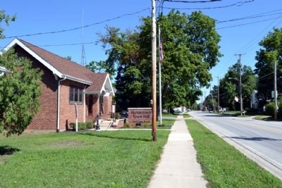
3. View to north along Lima Road
Credits. This page was last revised on June 16, 2016. It was originally submitted on August 20, 2014, by Duane Hall of Abilene, Texas. This page has been viewed 1,861 times since then and 71 times this year. Photos: 1, 2, 3. submitted on August 20, 2014, by Duane Hall of Abilene, Texas.
