
Near Clifton in Fairfax County, Virginia — The American South (Mid-Atlantic)
Old Dominion Stone Company Millstone
August 14, 2014
1. Old Dominion Stone Company Millstone Marker
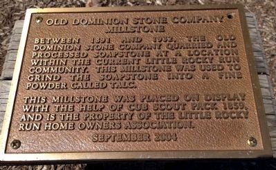
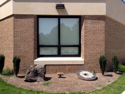
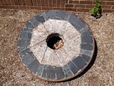
Between 1891 and 1932, the Old Dominion Stone Company quarried and processed soapstone at a location within the current Little Rocky Run community. This millstone was use to grind the soapstone into a fine powder called talc.
This millstone was place on display with the help of Cub Scout Pack 1859, and is the property of the Little Rocky Run Home Owners Association.
Erected 2004 by Little Rocky Run Home Owners Association.
Topics. This historical marker is listed in this topic list: Industry & Commerce. A significant historical year for this entry is 1891.
Location. 38° 49.241′ N, 77° 25.043′ W. Marker is near Clifton, Virginia, in Fairfax County. It can be reached from the intersection of Springstone Drive and Union Springs Lane, on the left when traveling west. Marker is located at the entrance of Union Mills Elementary School. Touch for map. Marker is at or near this postal address: 13611 Springstone Dr, Clifton VA 20124, United States of America. Touch for directions.

Regionally, this marker is in the Washington Metropolitan Area and in Northern Virginia. It is also in the American South,
this page online
Other nearby markers. At least 8 other markers are within 2 miles of this marker, measured as the crow flies: Civil War Earthworks (approx. half a mile away); Civil War Fortifications (approx. 1.1 miles away); Military Railroad Terminus (approx. 1.2 miles away); Mystery Of The Centreville Six (approx. 1.3 miles away); Newgate Tavern (approx. 1½ miles away); Convicts and Slaves (approx. 1½ miles away); Archaeology at Newgate Tavern (approx. 1½ miles away); Harrison House (approx. 1½ miles away).
Also see . . . Moving a Piece of History. Centre View, September 1, 2004 (Submitted on August 23, 2014.)
August 14, 2014
2. Old Dominion Stone Company Millstone Marker
August 14, 2014
3. Old Dominion Stone Company Millstone
Credits. This page was last revised on March 28, 2022. It was originally submitted on August 23, 2014. This page has been viewed 883 times since then and 22 times this year. Photos: 1, 2, 3. submitted on August 23, 2014. • Bernard Fisher was the editor who published this page.
