Knoxville in Knox County, Tennessee — The American South (East South Central)
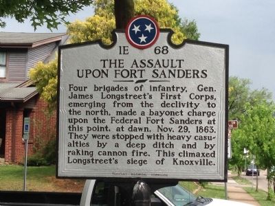
The Assault Upon Fort Sanders
Erected by Tennessee Historical Commission. (Marker Number 1E 68.)
Topics and series. This historical marker is listed in these topic lists: Forts and Castles • War, US Civil. In addition, it is included in the Tennessee Historical Commission series list. A significant historical date for this entry is October 29, 1863.
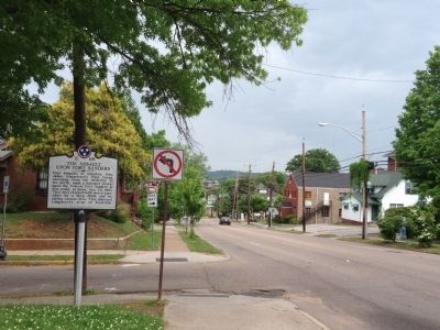
Location. 35° 57.537′ N, 83° 56.034′ W. Marker is in Knoxville, Tennessee, in Knox County. Marker is at the intersection of 17th Street SW and Laurel Avenue, on the left when traveling north on 17th Street SW. Touch for map. Marker is in this post office area: Knoxville TN 37916, United States of America. Touch for directions.
Other nearby markers. At least 8 other markers are within walking distance of this marker. Fort Sanders U.D.C. Monument (within shouting distance of this marker); Fort Sanders (about 300 feet away, measured in a direct line); 79th New York Infantry (Highlanders) Monument (approx. 0.2 miles away); a different marker also named Fort Sanders (approx. 0.2 miles away); General Clifton Bledsoe Cates (approx. 0.3 miles away); James Rufus Agee (approx. 0.3 miles away); Fort Byington (approx. 0.3 miles away); Wait Field (approx. 0.3 miles away). Touch for a list and map of all markers in Knoxville.
Also see . . . Battle of Fort Sanders. Wikipedia (Submitted on August 24, 2014.)
Credits. This page was last revised on September 22, 2020. It was originally submitted on August 24, 2014, by Michael Manning of Woodlawn, Tennessee. This page has been viewed 848 times since then and 37 times this year. Photos: 1, 2. submitted on August 24, 2014, by Michael Manning of Woodlawn, Tennessee. • Bernard Fisher was the editor who published this page.

