Fisherman's Wharf in San Francisco City and County, California — The American West (Pacific Coastal)
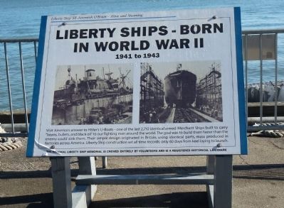
Liberty Ships – Born in World War II
1941 to 1943
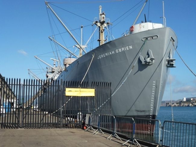
— Liberty Ship SS Jeremiah O’Brien - Alive and Steaming —
Inscription.
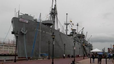
Visit America’s answer to Hitler’s U-Boats – one of the last 2,710 identical armed Merchant Ships built to carry “beans, bullets and black oil" to our fighting men around the world. The goal was to build them faster than the enemy could sink them. Their simple design originated in Britain, using identical parts, mass produced in factories across America. Liberty Ship construction set all time records: only 60 days from laying to launch.
The National Liberty Ship Memorial is crewed entirely by volunteers and is a Registered Historical Landmark.
Erected by The National Liberty Ship Memorial, Inc.
Topics and series. This memorial is listed in these topic lists: Industry & Commerce • War, World II • Waterways & Vessels. In addition, it is included in the National Historic Landmarks series list.
Location. 37° 48.629′ N, 122° 25.038′ W. Marker is in San Francisco, California, in San Francisco City and County. It is in Fisherman's Wharf. Memorial is on Fisherman's Wharf - Pier 45 north of The Embarcadero. Touch for map. Marker is at or near this postal address: Pier 45, Fisherman's Wharf, San Francisco CA 94133, United States of America. Touch for directions.
Other nearby markers. At least 8 other markers are within walking distance of this marker. USS Pampanito (SS-383) (about 500 feet away, measured in a direct line); What a Bargain! (about 700 feet away); Dominic Paul DiMaggio (approx. 0.2 miles away); The Port in Action (approx. 0.2 miles away); Why Here? (approx. ¼ mile away); Highway 101 (approx. ¼ mile away); Hyde Street Pier Was Part of Highway 101 (approx. ¼ mile away); Sanitation at Sea (approx. ¼ mile away). Touch for a list and map of all markers in San Francisco.
Related markers. Click here for a list of markers that are related to this marker. To better understand the relationship, study each marker in the order shown.
Also see . . .
1. ‘SS Jeremiah O’Brien’ National Liberty Ship Memorial. Memorial website homepage (Submitted on October 12, 2012, by Richard E. Miller of Oxon Hill, Maryland.)
2. Capt. Jeremiah O'Brien (1744–1818), Massachusetts State Navy. Wikipedia entry (Submitted on October 13, 2012, by Richard E. Miller of Oxon Hill, Maryland.)
3. U.S. Maritme Commission, 1936-1950. Website homepage (Submitted on October 13, 2012, by Richard E. Miller of Oxon Hill, Maryland.)
4. Naval Armed Guard Service in WWII. Website homepage:
... Sailors of the U.S. Navy Armed Guard served as gunners, signal men and radio operators on cargo ships, tankers, troop ships and other merchant vessels. ... (Submitted on October 14, 2012, by Richard E. Miller of Oxon Hill, Maryland.)
Additional keywords. San Francisco Maritime National Park
Credits. This page was last revised on July 14, 2023. It was originally submitted on October 12, 2012, by Richard E. Miller of Oxon Hill, Maryland. This page has been viewed 1,043 times since then and 20 times this year. Last updated on August 24, 2014, by Richard E. Miller of Oxon Hill, Maryland. Photos: 1, 2. submitted on October 12, 2012, by Richard E. Miller of Oxon Hill, Maryland. 3. submitted on October 13, 2012, by Richard E. Miller of Oxon Hill, Maryland. • Bill Pfingsten was the editor who published this page.


