Ronceverte in Greenbrier County, West Virginia — The American South (Appalachia)
Ronceverte
Photographed by PaulwC3, August 22, 2014
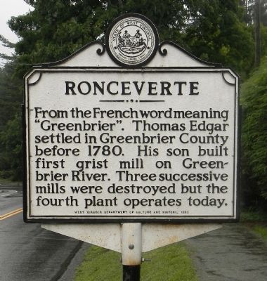
1. Ronceverte Marker
From the French word meaning “Greenbrier”. Thomas Edgar settled in Greenbrier County before 1780. His son built first grist mill on Greenbrier River. Three successive mills were destroyed but the fourth plant operates today.
Erected 1980 by West Virginia Department of History and Culture.
Topics and series. This historical marker is listed in this topic list: Settlements & Settlers. In addition, it is included in the West Virginia Archives and History series list. A significant historical year for this entry is 1780.
Location. 37° 44.855′ N, 80° 28.143′ W. Marker is in Ronceverte, West Virginia, in Greenbrier County. It is at the intersection of West Main Street (U.S. 219) and Locust Street, on the right when traveling south on West Main Street. Touch for map. Marker is in this post office area: Ronceverte WV 24970, United States of America. Touch for directions.

Regionally, this marker is in the Southern Coalfields. It is also in the American South, specifically in the Upper South, in Appalachia, and specifically in Southern Appalachia. Globally, it is in North America, the Western Hemisphere, the Western World,
this page online
Other nearby markers. At least 8 other markers are within 4 miles of this marker, measured as the crow flies: Bread Tradition (within shouting distance of this marker); Coach Howard M. "Toddy" Loudin (approx. ¼ mile away); The Hanging of David Creigh (approx. 1.3 miles away); Coffman (approx. 1.9 miles away); Confederate Saltpeter Works (approx. 2.7 miles away); Organ Cave (approx. 2.9 miles away); Pontiac's War / Welsh Cemetery (approx. 2.9 miles away); Lewisburg (approx. 3.8 miles away). Touch for a list and map of all markers in Ronceverte.
Also see . . . Ronceverte Historic District - National Register of Historic Places Registration Form. West Virginia Department of Arts, Culture and History website entry:
Ronceverte’s rich lumber and railroad history is found everywhere from the historic depot and coaling tower located in the heart of the downtown, to the vast array of historic homes built to accommodate railroad and lumber executives, and medical and education professionals. (Submitted on August 24, 2014, by PaulwC3 of Northern, Virginia.)
Photographed by PaulwC3, August 22, 2014
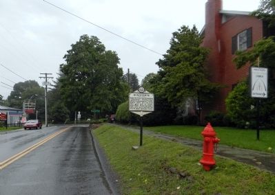
2. Wide view of the Ronceverte Marker
Credits. This page was last revised on January 25, 2022. It was originally submitted on August 24, 2014, by PaulwC3 of Northern, Virginia. This page has been viewed 1,158 times since then and 101 times this year. Photos: 1, 2. submitted on August 24, 2014, by PaulwC3 of Northern, Virginia.
