Kingsport in Sullivan County, Tennessee — The American South (East South Central)
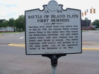
Battle of Island Flats
First Skirmish
Erected by Tennessee Historical Commission. (Marker Number 1A 94.)
Topics and series. This historical marker is listed in this topic list: War, US Revolutionary. In addition, it is included in the Tennessee Historical Commission series list. A significant historical month for this entry is July 1927.
Location. 36° 31.878′ N, 82° 30.844′ W. Marker is in Kingsport, Tennessee, in Sullivan County. Marker is at the intersection of Memorial Boulevard and East Center Street, on the right when traveling west on Memorial Boulevard. Touch for map. Marker is in this post office area: Kingsport TN 37660, United States of America. Touch for directions.
Other nearby markers. At least 8 other markers are within 3 miles of this marker, measured as the crow flies. A different marker also named Battle of Island Flats (approx. ¼ mile away); Martin-Dobyns House (approx. 1.3 miles away); Fort Patrick Henry (approx. 1.6 miles away); Stone-Penn House (approx. 1.7 miles away); Exchange Place (approx. 1.8 miles away); Roseland (approx. 1.8 miles away); Douglass High School (approx. 2.2 miles away); Donelson Flotilla (approx. 2.4 miles away). Touch for a list and map of all markers in Kingsport.
Credits. This page was last revised on June 16, 2016. It was originally submitted on August 29, 2014, by Lisa Barnett of Jonesborough, Tennessee. This page has been viewed 880 times since then and 45 times this year. Photo 1. submitted on August 29, 2014, by Lisa Barnett of Jonesborough, Tennessee. • Al Wolf was the editor who published this page.
