West Seventh - Fort Road in Saint Paul in Ramsey County, Minnesota — The American Midwest (Upper Plains)
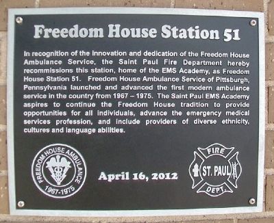
Freedom House Station 51
In recognition of the innovation and dedication of the Freedom House Ambulance Service, the Saint Paul Fire Department hereby recommissions this station, home of the EMS Academy, as Freedom House Station 51. Freedom House Ambulance Service of Pittsburgh, Pennsylvania launched and advanced the first modern ambulance service in the country from 1967-1975. The Saint Paul EMS Academy aspires to continue the Freedom House tradition to provide opportunities for all individuals, advance the emergency medical services profession, and include providers of diverse ethnicity, cultures and language abilities.
April 16, 2012
Erected 2012 by Saint Paul Fire Department.
Topics. This historical marker is listed in these topic lists: Charity & Public Work • Science & Medicine. A significant historical month for this entry is April 1968.
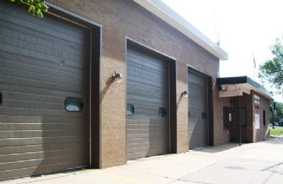
Location. 44° 56.498′ N, 93° 6.367′ W. Marker is in Saint Paul, Minnesota, in Ramsey County. It is in West Seventh - Fort Road. Marker is at the intersection of 7th Street West (State Highway 5) and Sherman Street, on the left when traveling west on 7th Street West. Touch for map. Marker is at or near this postal address: 296 7th Street West, Saint Paul MN 55102, United States of America. Touch for directions.
Other nearby markers. At least 8 other markers are within walking distance of this marker. Alexander Ramsey House (about 600 feet away, measured in a direct line); Irvine Park / Irvine Park Historic District (approx. 0.2 miles away); James J. Hill / The James J. Hill House (approx. 0.3 miles away); Summit–Selby Neighborhood (approx. 0.3 miles away); The Selby Streetcar Tunnel (approx. 0.4 miles away); Welcome to the Saint Paul Municipal Grain Terminal (approx. 0.4 miles away); River Commerce and the Upper Landing (approx. 0.4 miles away); A River in Decline (approx. 0.4 miles away). Touch for a list and map of all markers in Saint Paul.
Also see . . . Saint Paul Fire Department. (Submitted on August 29, 2014, by William Fischer, Jr. of Scranton, Pennsylvania.)
Credits. This page was last revised on February 12, 2023. It was originally submitted on August 29, 2014, by William Fischer, Jr. of Scranton, Pennsylvania. This page has been viewed 708 times since then and 44 times this year. Photos: 1, 2. submitted on August 29, 2014, by William Fischer, Jr. of Scranton, Pennsylvania.

