Harkers Island in Carteret County, North Carolina — The American South (South Atlantic)
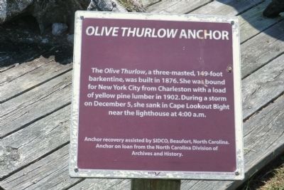
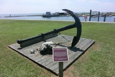
Olive Thurlow Anchor
Anchor recovery assisted by SIDCO, Beaufort, North Carolina. Anchor on loan from the North Carolina Division of Archives and History.
Topics. This historical marker is listed in this topic list: Waterways & Vessels. A significant historical month for this entry is December 1774.
Location. 34° 41.136′ N, 76° 31.584′ W. Marker is on Harkers Island, North Carolina, in Carteret County. Marker can be reached from Island Road (County Route 1335) east of Cape Point Drive, on the left when traveling east. The marker is on the grounds of the Cape Lookout National Seashore Visitor Center. Touch for map. Marker is in this post office area: Harkers Island NC 28531, United States of America. Touch for directions.
Other nearby markers. At least 8 other markers are within 2 miles of this marker, measured as the crow flies. Protecting People and Ships (within shouting distance of this marker); Harkers Island Visitor Center at Cape Lookout National Seashore (within shouting distance of this marker); Estuaries of the Sound (within shouting distance of this marker); Horizon of Islands (within shouting distance of this marker); Fort Hancock (about 500 feet away, measured in a direct line); Rain Gardens (approx. 0.2 miles away); Cisterns (approx. 0.2 miles away); In Honor and Rememberance (approx. 1.6 miles away). Touch for a list and map of all markers in Harkers Island.
Also see . . . Wreck of the Olive Thurlow. Cape Lookout National Seashore (Submitted on August 31, 2014.)
Additional keywords. Olive Thurlow Anchor
Credits. This page was last revised on June 16, 2016. It was originally submitted on August 30, 2014, by Don Morfe of Baltimore, Maryland. This page has been viewed 423 times since then and 13 times this year. Photos: 1, 2. submitted on August 30, 2014, by Don Morfe of Baltimore, Maryland. • Bernard Fisher was the editor who published this page.

