Suffolk, Virginia — The American South (Mid-Atlantic)
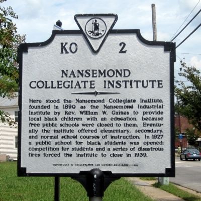
Nansemond Collegiate Institute
Photographed by Bernard Fisher, September 1, 2014
1. Nansemond Collegiate Institute Marker
Erected 1988 by Department of Conservation and Historic Resources. (Marker Number KO-2.)
Topics and series. This historical marker is listed in these topic lists: African Americans • Education. In addition, it is included in the Virginia Department of Historic Resources (DHR) series list. A significant historical year for this entry is 1890.
Location. 36° 43.581′ N, 76° 33.987′ W. Marker is in Suffolk, Virginia. It is at the intersection of East Washington Street (Business U.S. 13) and North 5th Street, on the left when traveling east on East Washington Street. Touch for map. Marker is in this post office area: Suffolk VA 23434, United States
this page online

Regionally, this marker is in Hampton Roads, specifically in Coastal Virginia, and in the Hampton Roads Metropolitan Area. It is also in the American South, specifically in the Upper South, in the Tidewater, and on the Eastern Seaboard. Globally, it is in the North Atlantic Region, North America, the Western Hemisphere, the Western World, and the Anglosphere. Historically, it finds itself in what was once the territory of the Mississippian Culture, one of the original Thirteen Colonies, one of the Confederate States of America, and the Antebellum South.
Other nearby markers. At least 8 other markers are within walking distance of this marker: Nansemond Industrial Institute (here, next to this marker); Safe Haven (approx. ¾ mile away); Jericho Ditch (approx. ¾ mile away); Remembrance Garden Monuments (approx. 0.9 miles away); Obici-Oderzo Fountain Marker (approx. 0.9 miles away); Confederate Monument (approx. 0.9 miles away); Civil War Militia of Suffolk and Nansemond County (approx. 0.9 miles away); Old City Hall Bell (approx. 0.9 miles away). Touch for a list and map of all markers
Photographed by Bernard Fisher, September 1, 2014
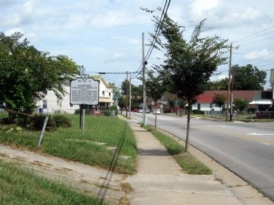
2. E Washington St (facing east)
Another marker is no longer nearby. East Suffolk School Complex (was about 700 feet away, measured in a direct line but has been confirmed missing).
Photographed by Bernard Fisher, September 1, 2014
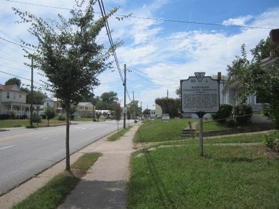
3. E Washington St (facing west)
Credits. This page was last revised on February 1, 2023. It was originally submitted on September 2, 2014, by Bernard Fisher of Richmond, Virginia. This page has been viewed 1,426 times since then and 46 times this year. Photos: 1, 2, 3. submitted on September 2, 2014, by Bernard Fisher of Richmond, Virginia.
