Victoria Boulevard Historic District in Hampton, Virginia — The American South (Mid-Atlantic)
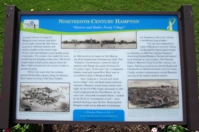
Ninteenth-Century Hampton
“Historic and Rather Pretty Village”
Once viewed as a “historic and rather pretty village” with tree-lined streets and brick sidewalks, Hampton would change almost overnight. As the Civil War began, thousands of additional troops poured into Fort Monroe. At the same time, thousands of escaped slaves—treated by the North as “contrabands of war”—were granted sanctuary near the fort. Realizing that Hampton could not be defended, Confederates put Hampton to the torch, leaving a smoldering heap of ashes.
The war also contained the seeds of Hampton’s recovery. Acting on the need for former slaves to gain an education, in 1868 Gen. Samuel Chapman Armstrong founded Hampton Normal and Agricultural Institute to train teachers. The National Soldiers' Home for Union Civil War veterans was begun. Fabulous tourist hotels like the Hygeia and Chamberlin at Old Point Comfort came into being. Finally, northern entrepreneurs turned Hampton into one of the nation’s seafood capitals.
(captions)
(left) 1861 engraving showing Fort Monroe, along with the Hygeia Hotel at Old Point Comfort. - Courtesy of the Hampton History Museum
(center) View from the Hampton River of Hamton Institute, now Hampton University. - Courtesy of the Hampton History Museum
(right) "Contraband" enslaved people settled in Hampton, building their homes near the ruins of the town burned by the Confederates Army in 1861. This image appeared in an 1865 issue of Harper's Weekly, based on a photograph taken in Hampton by Alexander Gardner. - Courtesy of the Hampton History Museum
Erected 2010.
Topics and series. This historical marker is listed in these topic lists: African Americans • Education • War of 1812 • War, US Civil. In addition, it is included in the Historically Black Colleges and Universities series list. A significant historical date for this entry is June 24, 1718.
Location. 37° 1.469′ N, 76° 20.611′ W. Marker is in Hampton, Virginia. It is in the Victoria Boulevard Historic District. Marker is at the intersection of Settlers Landing Road (U.S. 60) and South King Street, on the left when traveling west on Settlers Landing Road. Touch for map. Marker is at or near this postal address: 600 Settlers Landing Rd, Hampton VA 23669, United States of America. Touch for directions.
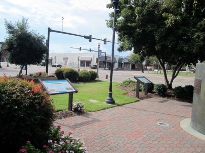
Other nearby markers. At least 8 other markers are within walking distance of this marker. Twentieth-Century Hampton (here, next to this marker); Eighteenth-Century Hampton (a few steps from this marker); Seventeenth-Century Hampton (a few steps from this marker); Langley Field: Creating an Air Force (a few steps from this marker); Langley Field: Discovering Aerospace (a few steps from this marker); Hampton (a few steps from this marker); Dr. Katherine G. Johnson (a few steps from this marker); Katherine Coleman Goble Johnson (within shouting distance of this marker). Touch for a list and map of all markers in Hampton.
Credits. This page was last revised on February 1, 2023. It was originally submitted on September 2, 2014, by Bernard Fisher of Richmond, Virginia. This page has been viewed 704 times since then and 16 times this year. Photos: 1, 2, 3. submitted on September 2, 2014, by Bernard Fisher of Richmond, Virginia.


