Hope Village in Portsmouth, Virginia — The American South (Mid-Atlantic)
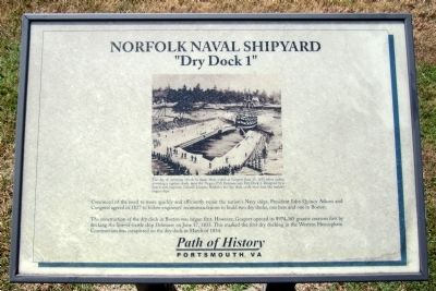
Norfolk Naval Shipyard
“Dry Dock 1”
— Path of History Portsmouth, VA —
The construction of the dry dock in Boston was begun first. However, Gosport opened its $974,365 granite creation first by docking the line-of-battle ship Delaware on June 17, 1833. This marked the first dry docking in the Western Hemisphere. Construction was completed on the dry dock in March of 1834.
(caption)
The day of careening vessels to repair them ended at Gosport June 17, 1833 when sailors powering a capstan slowly drew the 74-gun USS Delaware into Dry Dock 1. Designed by a famed civil engineer, Colonel Loammi Baldwin, the dry dock could then host the nation’s largest ships.
Topics and series. This historical marker is listed in these topic lists: Industry & Commerce • Waterways & Vessels. In addition, it is included in the ASCE Civil Engineering Landmarks, and the Former U.S. Presidents: #06 John Quincy Adams series lists. A significant historical month for this entry is March 1834.
Location. 36° 49.668′ N, 76° 17.836′ W. Marker is in Portsmouth, Virginia. It is in Hope Village. Marker can be reached from Lincoln Street east of 3rd Street, on the left when traveling east. Located in Gosport Park. Touch for map. Marker is in this post office area: Portsmouth VA 23704, United States of America. Touch for directions.
Other nearby markers. At least 8 other markers are within walking distance of this marker. A different marker also named Norfolk Naval Shipyard (a few steps from this marker); a different marker also named Norfolk Naval Shipyard (a few steps from this marker); a different marker also named Norfolk Naval Shipyard (within shouting distance of this marker); a different marker also named Norfolk Naval Shipyard (within shouting distance of this marker); Sail portion of the USS Thomas Jefferson (within shouting distance of this marker); a different marker also named Norfolk Naval Shipyard (within shouting distance of this marker); a different marker also named Norfolk Naval Shipyard (within shouting distance of this marker); a different marker also named Norfolk Naval Shipyard (within shouting distance of this marker). Touch for a list and map of all markers in Portsmouth.
Credits. This page was last revised on October 26, 2023. It was originally submitted on September 2, 2014, by Bernard Fisher of Richmond, Virginia. This page has been viewed 689 times since then and 53 times this year. Photo 1. submitted on September 2, 2014, by Bernard Fisher of Richmond, Virginia.
