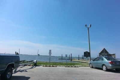
Morehead City in Carteret County, North Carolina — The American South (South Atlantic)
Atlantic Intracoastal Waterway
Completed in 1932 from Norfolk to Wilmington via Beaufort-Morehead City. Sen. F.M. Simmons of New Bern and Rep. J.H. Small of Washington led effort.
Topics. This historical marker is listed in this topic list: Waterways & Vessels. A significant historical year for this entry is 1932.
Location. 34° 43.347′ N, 76° 45.052′ W. Marker is in Morehead City, North Carolina, in Carteret County. Marker is on Arendel Street (U.S. 70) west of 34th Street, on the right when traveling east. Touch for map. Marker is at or near this postal address: 3409 Arendell Street, Morehead City NC 28557, United States of America. Touch for directions.
Other nearby markers. At least 8 other markers are within walking distance of this marker. Carolina City (about 500 feet away, measured in a direct line); Camp Glenn (about 700 feet away); Siege of Fort Macon (approx. 0.2 miles away); a different marker also named Carolina City (approx. 0.2 miles away); a different marker also named Carolina City (approx. 0.2 miles away); A United States Naval Section Base Inshore Patrol (approx. 0.2 miles away); North Carolina National Guard (approx. ¼ mile away); N.C. State Highway Patrol (approx. ¼ mile away). Touch for a list and map of all markers in Morehead City.
Credits. This page was last revised on June 16, 2016. It was originally submitted on September 9, 2014, by Don Morfe of Baltimore, Maryland. This page has been viewed 439 times since then and 26 times this year. Photos: 1, 2. submitted on September 9, 2014, by Don Morfe of Baltimore, Maryland. • Bernard Fisher was the editor who published this page.

